|
THE MARINE SEXTANT
|
|
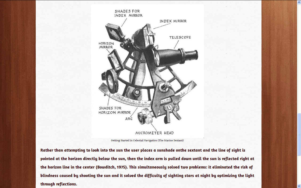
The sextant works based on the principle that a reflected ray of light leaves a plane surface at the same angle at which it strikes the surface, or “the angle of reflection is equal to the angle of incidence” (Bowditch, 1975) and the principle that two reflective planes or mirrors create an angle of inclination which, through logic and transposition, when doubled, equals the altitude of the celestial body:
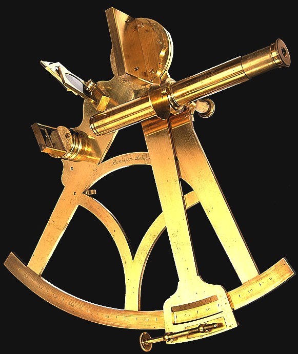
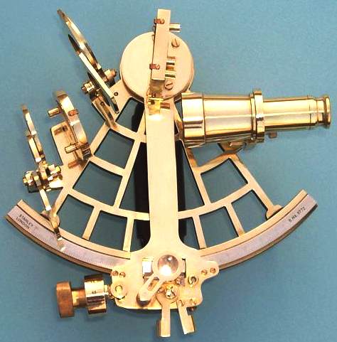
A sextant is a doubly reflecting navigation instrument that measures the angular distance between two visible objects. The primary use of a sextant is to measure the angle between an astronomical object and the horizon for the purposes of celestial navigation. The estimation of this angle, the altitude, is known as sighting or shooting the object, or taking a sight. The angle, and the time when it was measured, can be used to calculate a position line on a nautical or aeronautical chart—for example, sighting the Sun at noon or Polaris at night (in the Northern Hemisphere) to estimate latitude. Sighting the height of a landmark can give a measure of distance off and, held horizontally, a sextant can measure angles between objects for a position on a chart.
The principle of the instrument was first implemented around 1731 by John Hadley (1682–1744) and Thomas Godfrey (1704–1749), but it was also found later in the unpublished writings of Isaac Newton (1643–1727). Additional links can be found to Bartholomew Gosnold (1571–1607) indicating that the use of a sextant for nautical navigation predates Hadley's implementation. (This reference to Gosnold's use of a sextant, in a popular British travel magazine article, rather than in a nautical history journal, does not cite sources, and is very probably inaccurate.) In 1922, it was modified for aeronautical navigation by Portuguese navigator and naval officer Gago Coutinho.
WHERE ARE WE - Calculating longitude and position require understanding nautical almanacs, adjusting for errors, declinations, and star charts, and that is just to identify a position, not plot a course. The sextant allowed for really precise measurements of distances and altitudes, which opened the calculations necessary to actually get a “fix” on a position. When combined with the spherical trigonometry of the navigational triangle: the spherical triangle with a side for polar distance, or the angular distance between the global position of the star; the colatitude which is the angular distance between the pole and the navigator; and the coaltitude, the distance between the navigator and the star, the sextant allowed for extremely precise calculations of latitude. The GPS system has largely replace traditional marine instruments, but one should always know how to find your position on a chart when the lights go out.
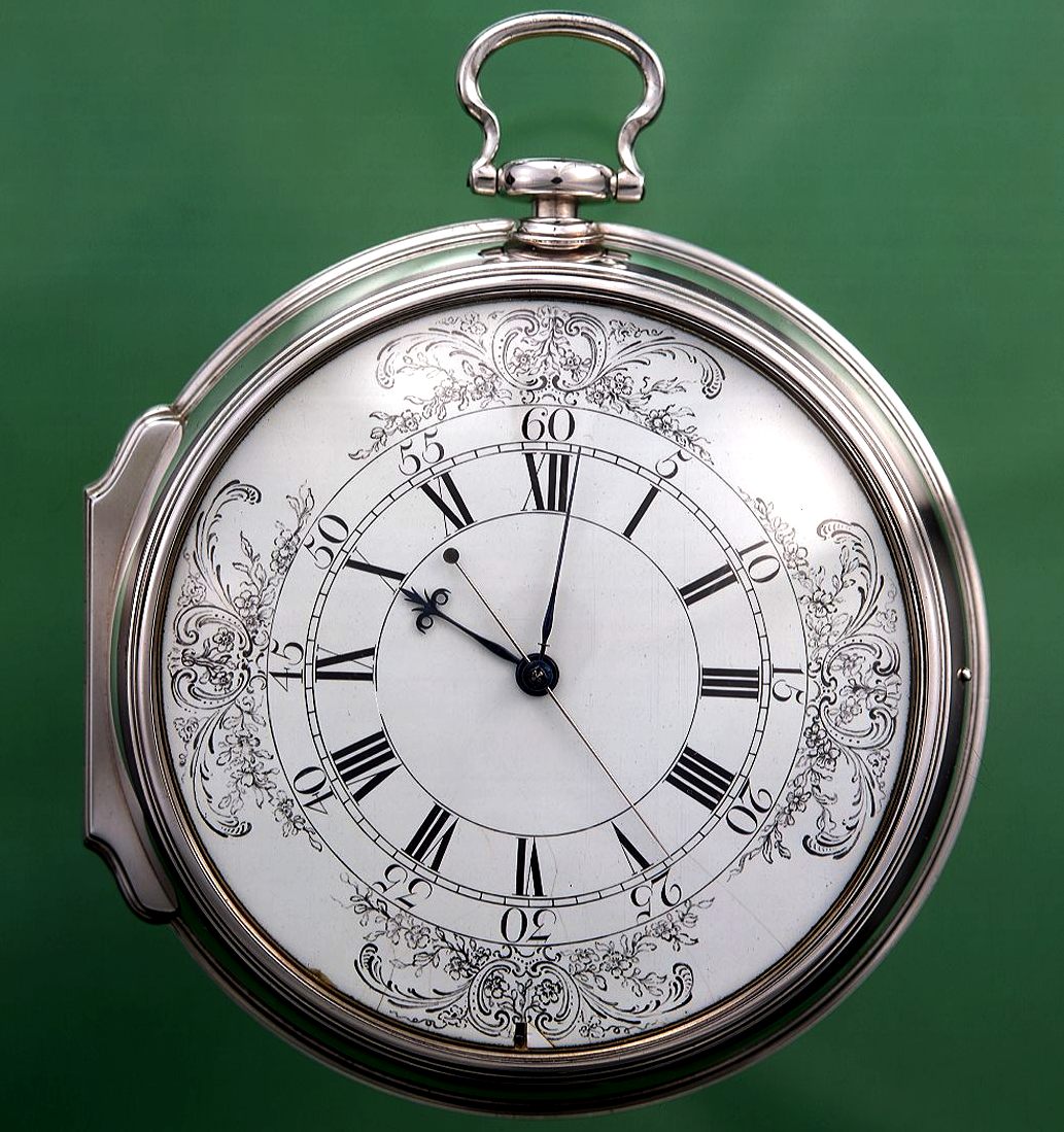
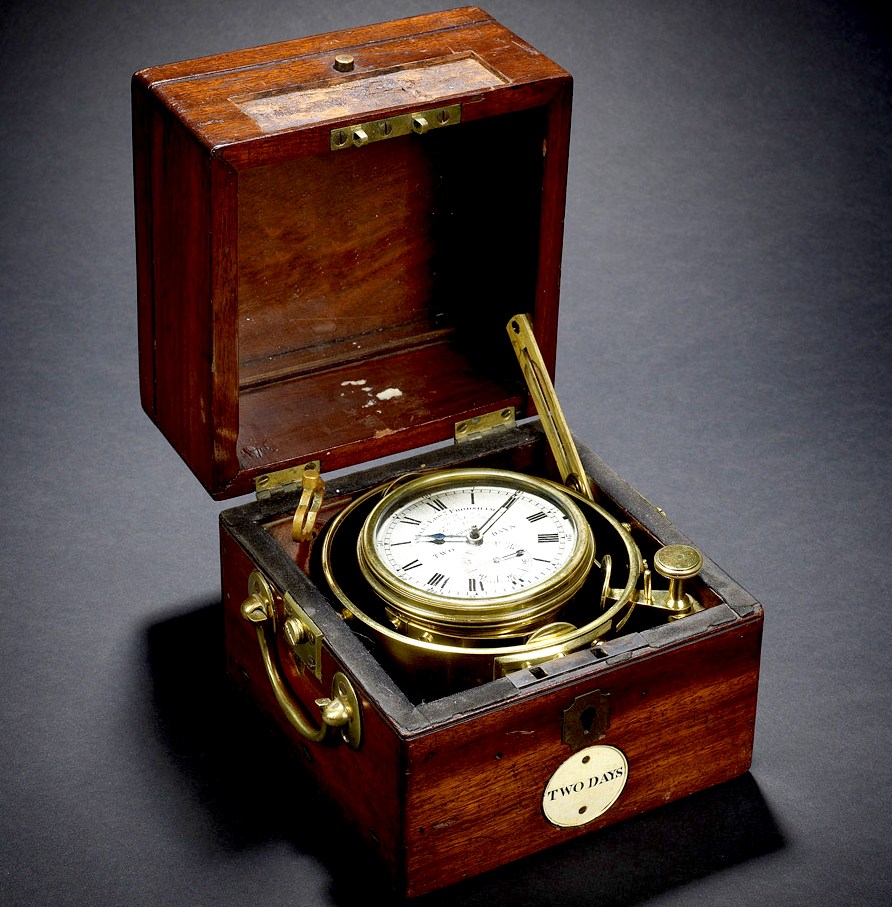
MARINE CHRONOMETER
MISSING LINK - The H4 marine chronometer, as perfected by John Harrison many years before his death in 1776. It was the size of a large pocket watch. Unlike the marine chronometer that can be attributed to one man, the sextant is a development of the octant and that developed from other means, hence, the sextant is the product of many different minds. Clocks were not accurate enough before John Harrison to be considered as a true navigational instrument.
SOLUTIONS
- The chronometer was vital to the ability to create charts and safely navigate the world. The first chronometers were invented by a carpenter's son:
John
Harrison.
This gimbaled Marine Chronometer seen above was one on H.M.S. Beagle during its second voyage (1831-1836) with Charles Darwin onboard. It sailed to the coast of South America, across the South Pacific towards the Galapagos Islands, New Zealand and Australia, in order to help establish a chain of reliable navigational co-ordinates around the globe.
LINKS & REFERENCE
https://www.atlasobscura.com/places/john-harrisons-marine-chronometers https://www.britannica.com/biography/John-Harrison-British-horologist
|
|
This website is Copyright © 2019 Bluebird Marine Systems Limited. The name Bluebird™ is a registered trademarks.
|