|
|
GULF OF FINLAND
|
|
|
MAP
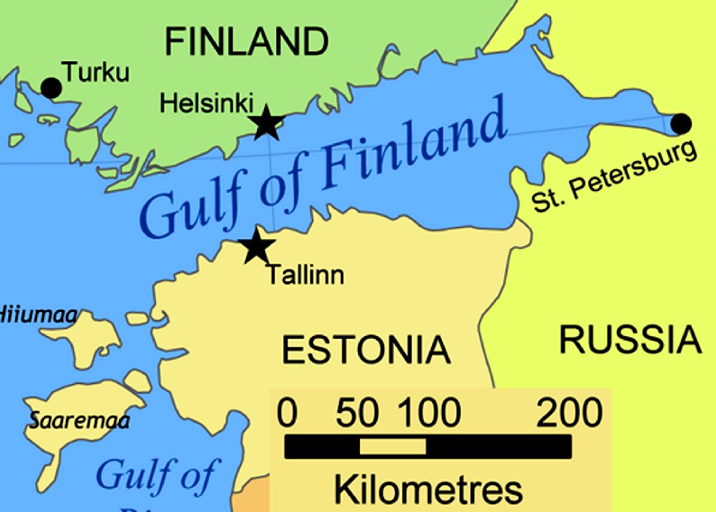
- The Gulf of Finland is a very shallow bay of 29 500 km2, with a length of 428km and width up to 120km. The narrowest distance across the Gulf is 52km from Porkkala to Rohuneeme outside Tallinn. The deepest parts of the Gulf are at a depth of only 80-100m at its mouth. There are depths of over 100m on the southern coast, while the northern side never exceeds 60m. About 5% of the water mass in the Baltic Sea is located in the Gulf of Finland.
EUROPEAN
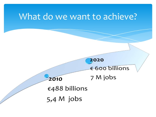
MARITIME DAY, TURKU - Focus on investment in the Blue Economy
- 17/05/2016
CREATION - The European Maritime Day (EMD) was officially created on 20 May 2008 where the President of the European Parliament Hans-Gert Pöttering, Council President Janez Janša, and Commission President José Manuel Barroso signed a Joint Tripartite Declaration establishing it.
In Turku, over 1000 participants will be able to choose among 21 stakeholder workshops, 5 thematic sessions (Investing in blue growth, Improving ocean governance, Boosting skills development, Harnessing clean energy and Facilitating joint action) and 2 'Leadership Exchange' panels. The two-day event is organised by the European Commission in cooperation with the City of Turku and the Finnish Government.
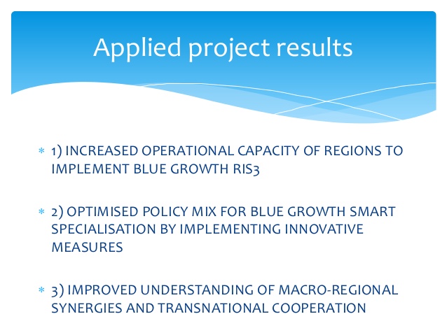
BLUE GROWTH - How the project results were applied
ABOUT THE GULF OF FINLAND
The Gulf of Finland is the easternmost arm of the Baltic Sea. It extends between Finland (to the north) and Estonia (to the south) all the way to Saint Petersburg in Russia, where the river Neva drains into it. Other major cities around the gulf include Helsinki and Tallinn. The eastern parts of the Gulf of Finland belong to Russia, and some of Russia's most important oil harbours are located farthest in, near Saint Petersburg (including Primorsk). As the seaway to Saint Petersburg, the Gulf of Finland has been and continues to be of considerable strategic importance to Russia. Some of the environmental problems affecting the Baltic Sea are at their most pronounced in the shallow gulf.
POLLUTION
Fish catchment decreased 10 times between 1989 and 2005. Apart from pollution, another reason for that is hydraulic and engineering works. For example, construction of new ports in Ust-Luga and Vysotsk and on Vasilievsky Island adversely affected the spawning of fish. Extraction of sand and gravel in the Neva Bay for the land reclamation destroy spawning sites of European smelt.
Construction of the Saint Petersburg Dam reduced water exchange of the Neva Bay with the eastern part of the gulf by 10–20% that increased the contamination level of Neva Bay. The largest changes occur within 5 km (3 mi) from the dam. Some shallow areas between Saint Petersburg and the dam are turning into swamps. Waterlogging and the associated rotting of plants may eventually lead to eutrophication of the area. Also worrying is expansion of oil ports in the gulf and the construction of a treatment center for spent fuel from the Leningrad Nuclear Power Plant.
The port of Kronstadt is currently serving as a transit point for the import in Russia of radioactive waste through the Baltic Sea. The waste, mostly depleted uranium hexafluoride, is further transported through Saint Petersburg to Novouralsk, Angarsk and other cities of eastern Russia. This transit point will be moved from Saint Petersburg to the port Ust-Luga within the Border Security Zone of Russia, as decided by the Russian government in 2003 (Order No. 1491-r of 14 October 2003). This step should reduce the ecological risks for Saint Petersburg.
ECONOMY
Passenger transport on the gulf includes a number of ferry lines which connect the following ports: Helsinki and Hanko (Finland), Mariehamn (Åland Islands), Stockholm and Kappelsher (Sweden), Tallinn and Paldiski, Rostock (Germany), Saint Petersburg and Kaliningrad (Russia), as well as many other cities.
Another major and historical activity in the gulf is fishing, especially on the northern coast near Vyborg, Primorsk and on the southern coast near Ust-Luga. Commercial fish species are herring, sprats, European smelt, whitefishes, carp bream, roaches, perch, European eel, lamprey and others. In 2005, the catchment was 2000 tons by the ships of Saint Petersburg and Leningrad Oblast alone.
In September 2005 the agreement was signed on the construction of the Nord Stream offshore gas pipeline on the Baltic Sea, from Vyborg to the German city of Greifswald. The first line should become operational in 2011.
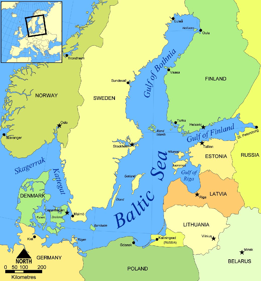
BALTIC SEA - Map showing the geographical location of the Gulf of Finland in Europe
BLUE
GROWTH
ACIDIFICATION - ADRIATIC - ARCTIC - ATLANTIC - BALTIC - BAY BENGAL - BERING - BLACK - CARIBBEAN - CORAL - EAST CHINA ENGLISH CH - GOC - GULF GUINEA - GULF MEXICO - INDIAN - IOC - IRC - MEDITERRANEAN - NORTH SEA - PACIFIC - PERSIAN GULF
RED
SEA - SEA
JAPAN - STH
CHINA - PLASTIC
- PLANKTON - PLASTIC
OCEANS - SEA
LEVEL RISE - UNCLOS
- UNEP
WOC
- WWF AMAZON - BURIGANGA - CITARUM - CONGO - CUYAHOGA - GANGES - IRTYSH - JORDAN - LENA - MANTANZA-RIACHUELO MARILAO
- MEKONG - MISSISSIPPI - NIGER - NILE - PARANA - PASIG - SARNO - THAMES
- YANGTZE - YAMUNA - YELLOW
LINKS & REFERENCE
http://www.europeanstraits.eu/Partners/Gulf-of-Finland http://www.europeanstraits.eu/ https://ec.europa.eu/maritimeaffairs/policy/biotechnology_en
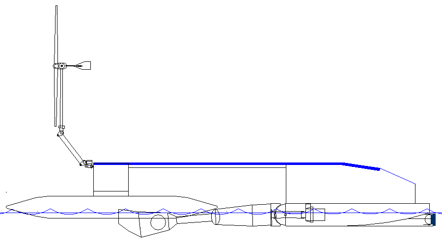
CLEAN UP YOUR OCEAN - Based on the Bluefish ZCC concept, that above feasibility design is a proposed trimaran test rig, using off-the-shelf components to get a feel for the concept. This is in no way a complete solution, but then we have to start somewhere. What we learn from these small scale experiments, could eventually help us to formulate a dual purpose, ocean capable cruiser, to clean up the Gulf of Finland and local harbours, with a view to cleansing the marine environment and improving the quality of beaches and locally caught fish.
|
||
|
This
website is Copyright © 2024 Bluebird Marine Systems Limited.
The names AmphiMax™,
Bluebird™,
Bluefish™,
Miss Ocean™, SeaNet™,
SeaVax™,
and the blue bird in flight
|
||
