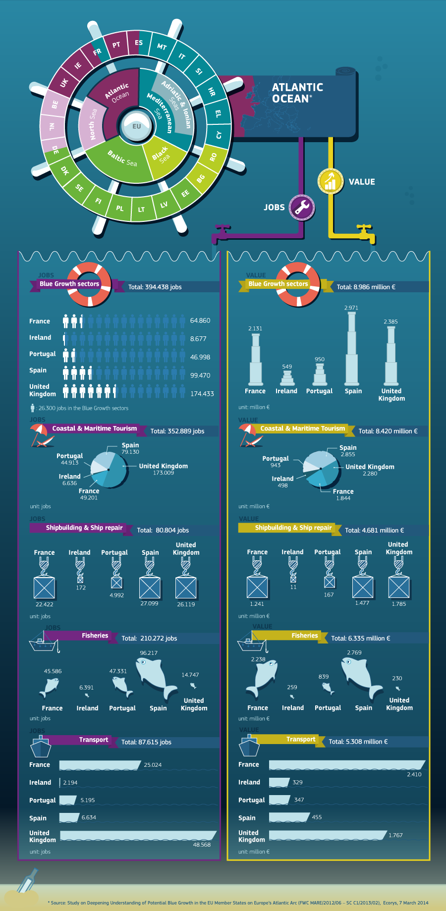
|
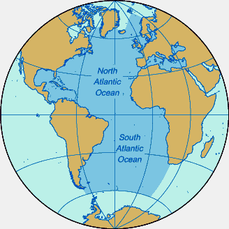
MAP
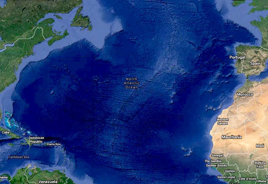
- North Atlantic Ocean

EU
4TH ATLANTIC PLATFORM STAKEHOLDER CONFERENCE, GLASGOW 8 NOVEMBER 2017
The 4th Atlantic Stakeholder Platform Conference (ASPC2017)
is to be held on 8 November 2017 in Glasgow, United Kingdom.
The Atlantic Action Plan aims to revitalise the marine and maritime economy in the Atlantic area. It demonstrates how the EU’s Atlantic Member States and their coastal regions can help create sustainable growth and drive forward the
“blue economy” while preserving the environmental and ecological stability of the Atlantic Ocean. The Action Plan encourages the five Atlantic EU Member States, France, Portugal, Spain, the United Kingdom and Ireland, to work together towards sustainable and inclusive
growth in their coastal areas.
The Atlantic Action Plan highlights the benefits of sharing information, costs, results and best practices as well as, promoting the generation of ideas for further areas of cooperation of maritime activity.
The European Commission set up the Support Team for the Atlantic Action Plan, in August 2014, to provide guidance and proactive support for public and private organisations, research institutions and investors, to find funding sources and project partners across the Atlantic to implement the Action Plan.
The Support Team invites stakeholders to an annually organised Atlantic Stakeholder Conference, bringing together all interested actors to share knowledge and facilitating networking and matchmaking activities.
The thematic focus of the 4th Atlantic Stakeholder Platform Conference will be on topics related to Priority 4 of the Atlantic Action Plan: “Create a socially inclusive and sustainable model of regional development”.

PBS
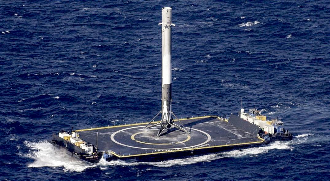
NEWSHOUR - SPACE X MAKE ATLANTIC DRONE LANDING, APRIL 10 2016
Four failed attempts and years of effort paid off Friday, as the SpaceX Falcon 9 rocket booster re-entered Earth’s atmosphere and lowered itself
Thunderbirds fashion, vertically, onto a floating platform in the Atlantic Ocean — the company’s first successful landing at sea.
The aerospace and space transport company has landed the rocket on terra firma once before, but its size — 12 stories tall and a diameter about the length of
Volkswagen Beetle — made bringing it to a platform bobbing in the open ocean
challenging, and somewhat puzzling at the same time.
According to an AFP report, SpaceX CEO Elon Musk is quoted as saying that the ability to safely land a rocket so it can be used again — as opposed to the traditional method of deploying a new rocket for each launch and allowing used rockets to crash-land in the ocean — will make it cheaper to get to space, and more Eco-friendly.
There is though nothing eco at all about space travel, except only in
several million years when sustainability will mean abandoning planet
earth because we have burned our home up with climate
change.
Musk, of Tesla
and Paypal fame, is quoted as saying that it costs roughly $300,000 to fuel the rocket with
a combination of kerosene and liquid oxygen and $60 million to build a new
one: “If you have got a rocket that can be fully and rapidly reused, it is somewhere on the order of a 100-fold cost reduction, in marginal
costs.”
President Barack Obama was quick to congratulate SpaceX Friday after the rocket gracefully alighted on the oceanic landing platform, a drone ship that SpaceX christened “Of Course I Still Love You.”
Since it was founded in 2002, SpaceX, whose name is short for Space Exploration Technologies Corp., has rapidly become a major player in the American aerospace industry and an important part of
NASA’s future plans.
The agency has already awarded contracts worth over $4 billion to the California-based company as part of its effort to reduce its reliance on Russian space shuttles. And before it landed Friday, the rocket launched into orbit a cargo craft laden with supplies for astronauts at the International Space Station.
Ref: Daniel Costa-Roberts

11
NOV 2015 - THE TRANSAT - RACE
STARTS 2 MAY 2016
The Transat began life when a handful of British sailors made a bet to see if they could sail across the Atlantic to America single-handed and who could do it the fastest. Among them were
Sir Francis Chichester and Blondie Hasler. When they came up with their plan, it was at first ridiculed
as foolhardy. The idea of a single-handed yacht race was revolutionary and almost unheard of at the time. But they
were men on a mission.
Hasler sought sponsorship for the race, but by 1959, no one had been prepared to back him
or his mad idea. Then, The Observer newspaper
took a chance, and in 1960, under the management of the Royal Western Yacht Club of England, the Observer Single-handed Trans-Atlantic Race, or OSTAR, was born.
One hundred and fifteen people expressed an interest in taking part.
Fifty declarations of intent were received and eight boats entered, but only five
daring sailors crossed the start line off Plymouth.
In those days there were no satellite navigation systems, just hand-held compasses and sextants. Without the technology that we have nowadays, little was heard from the competitors during the race and fears grew for their safety. But,
conclusively, Chichester was first to arrive in New York after 40 days, 12 hours and 30 minutes at sea.
He said: “Every time I tried to point Gypsy Moth at New York, the wind blew dead on the
nose.” “It was like trying to reach a doorway with a man in it aiming a hose at you.”
The 1960 race was the only edition without multihulls and also the only edition (until now) to go from Plymouth to
New York.
Entries: entries@thetransat.com
Contact: contact@thetransat.com
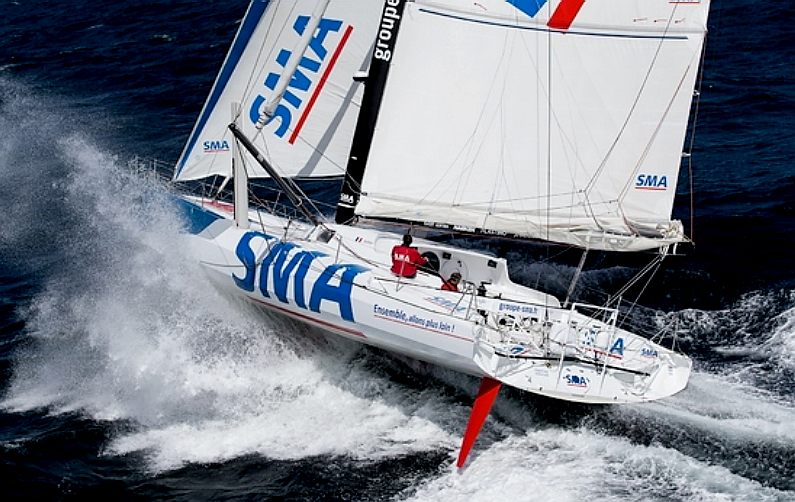
PAUL
MEILHAT - The skipper of the IMOCA 60, SMA, has today confirmed his participation in The Transat 2016.
SMA is the first of the IMOCA class to enter the solo classic from Plymouth to New York that sets sail on 2nd of May. Tracing its roots back to 1960, the race will be contested in four classes – IMOCA 60s, Multi 50s, Class 40s and giant multihulls or Ultimes with no limitation in upper size in that class.
Born just outside Paris, Paul Meilhat, the 33-year-old SMA skipper who now lives in Brest, will race in The Transat as part of his build-up to the 2016 Vendée Globe solo round-the-world race.
“The Transat will actually only be my second solo transatlantic race ever but I’m happy to be taking part for that very reason,” said Meilhat.
“I know many IMOCA skippers see The Transat as a training ground for the Vendée Globe and the truth is, it’s important to have as much training as possible and you know what they say… if you want to be a good sailor in 30 knots of wind you had better learn to sail in 40 knots and that’s the opportunity The Transat gives us.”
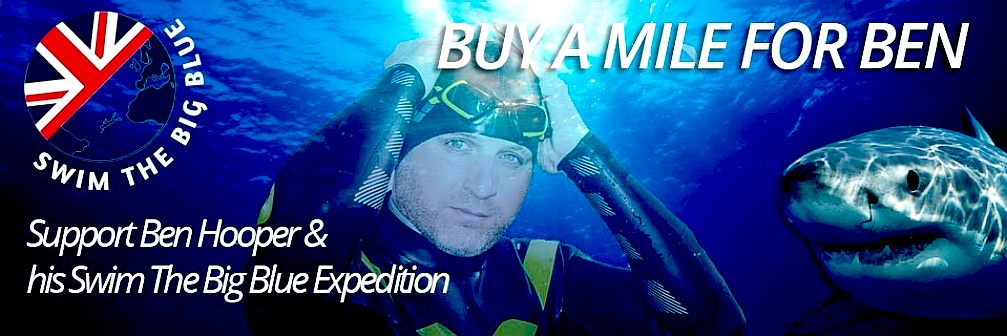
BEN
HOOPER'S: SWIM THE BIG BLUE EXPEDITION - NOV 2015
Departing: January 2016 in Dakar Harbour, Senegal.
Arriving: May 2016 in Natal, North-East Brazil.
The "Swim The Big Blue" team say that they will chart a course from Dakar, Senegal to Natal, Northern
Brazil across the open Mid-South Atlantic Ocean. Using freestyle
swimming (front crawl) Ben
Hooper is to swim up to a total of 12 hours per day, over 120 days. His epic swim will take him over 30-foot surges, passing through
shark inhabited regions, and without doubt, he will encounter jelly fish,
flying fish and a harsh Equatorial
sun. Then, there will be “The Doldrums” and her stillness, humidity, lack of movement…yet at any time the
dead calm could explode into raging
storms, heavy squalls and lightning to sting the sea.
Let
us be clear that this is an assisted swim, in that Ben will not be in the
water all of the time, but supported by a boat with shark
protection measures. It is not like swimming the English
Channel, where it is literally man against the elements. No man
could or would want to try and swim such a long distance without
assistance, he is not biologically equipped for such a marathon event. So,
we'll cheat a little.
SWIM
THE BIG BLUE - The swim, on a daily basis, will be broken down into a maximum of two 6-hour periods (or up to 12 hours per day). Between the two 6-hour sessions, there will be two hours of rest on the support boat. During this rest period (and overnight up to 10 hours), Ben will be aboard the boat where he will sleep and consume a high carbohydrate, fat and protein diet as well as
dehydrating. He may burn up to 12,000 calories per day.
The boat and crew, will note the GPS position of each swim entry and exit, and will account for drift in order to add any vacant distances back into the swim or to the end of the swim, thereby ensuring the whole distance of the originally intended route is completed. As a further measure, the option of use of a sea anchor may reduce the drift ensuring that the total mileage spent out of the
water is minimized, recorded and still swum before the end of the expedition: a total of up to 2000 miles in approximately 90 days; 128,720 lengths of a 25m swimming pool; 3.21 million meters of open ocean using around a total of 2.1 million strokes depending on fatigue, weather and
sharks - the target is up to an English Channel swim distance per day.
During each swim leg Ben will feed and drink approximately every sixty-minutes while in the water. Always without touching the boat or any other supporting device, the crew will pass supplies to Ben by throwing or by pole depending on conditions. Unless there is an emergency or safety risk, Ben shall not have any other form of physical contact with the boat (other than being passed food/drink) during the two 6-hour periods of swimming.
Swimming in sea temperatures ranging from 20 – 30 degrees centigrade, (68 – 86 Fahrenheit), with currents from 1 – 7 knots flowing westward and north-west, this will be a
grueling trial of endurance and mental strength unlike any before. If successful, Ben
claims that he will be the first man in history to have swum an ocean in
full. He may also become the first man to transparently detail his swim - swimming the exact mileage of the intended straight line crossing,
which is approximately 1731 miles as the crow
flies.
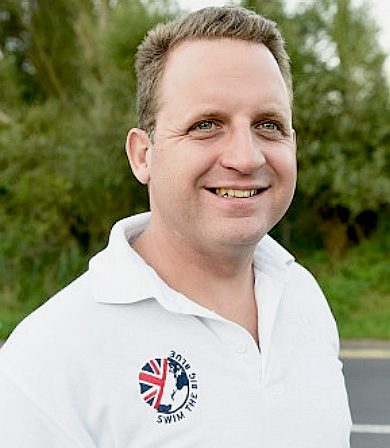
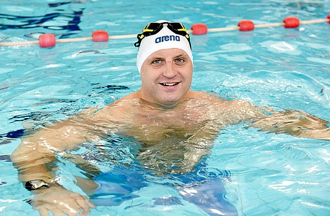
ABOUT
BEN
Ben was born in
London, United Kingdom, and as a child moved within the UK and EU with his family and the British
Army. As an adult Ben has served with the military, police and worked within mental health and Psychology. In his spare time, he writes fiction and is a 2* AIDA freediver and Open Water PADI
scuba
diver. His love of open water and swimming, is second only to being a father.
Ben's inspirational story of surviving premature birth, collapsed lungs and
death in ICU at birth, is highlighted further by his drowning at five-years of age in a swimming pool in
Belgium.
Oddly, that only served to enthuse him and drive on his love of water and the sea.
During his teen years, Ben took part in a few long distance swims for charity and recreationally trained in the pool, with running and
golf being his other passions. Yet as adulthood dawned, he moved to training for distance swimming, middle distance running and eventually, a period of triathlon amateur competition. Later, whilst living in Fuerteventura, he turned his focus to spending more time in the swimming pool and sea swimming up to 25
miles in a day and freediving,
scuba and more long distance swimming in the UK, Atlantic and Mediterranean. Ben remains a regular guy
save for wanting to achieve this extraordinary record.
CONTACT
BEN & HIS TEAM
General
information from Ben and his support team: info@swimthebigblue.com
Events
and Sponsorship enquiries,
Rebecca Logue: sponsorteam@swimthebigblue.com
Marketing/Media/Press
enquiries:
UK
Regional - Michelle Heather of Pink Elephant Marketing +44 (0) 1242
230524
Email:
pinkelephantmarketing@outlook.com
UK
National - Anthony Harvison of Palamedes PR on +44 (0) 207
1383067
Email:
anthony.harvison@palamedes.co.uk
Ben's
agent - Sacha Gemili: nsrg17@hotmail.com
NORTH
ATLANTIC DEAD ZONES, MAY 2015
Researchers have discovered dead zones in the Atlantic Ocean with
oxygen levels low enough to kill most marine life, according to a report published Thursday. It added that it was the first time such zones, which usually occur near coastlines, were observed in the open ocean.
Dead zones are areas of the ocean depleted of oxygen. Most marine animals, like fish and crabs, cannot live within these regions, where only certain microorganisms can survive. In addition to the environmental impact, dead zones are an economic concern for commercial fishing, with very low oxygen concentrations having been linked to reduced fish yields in the Baltic Sea and other parts of the world.
This research is presented in the paper ‘Open ocean dead zones in the tropical North Atlantic Ocean’, published in the EGU open access journal Biogeosciences on 30 April 2015.
Citation: Karstensen, J., Fiedler, B., Schütte, F., Brandt, P., Körtzinger, A., Fischer, G., Zantopp, R., Hahn, J., Visbeck, M., and Wallace, D.: Open ocean dead zones in the tropical North Atlantic Ocean, Biogeosciences, 12, 2597-2605, doi:10.5194/bg-12-2597-2015, 2015.
The team is composed of J. Karstensen, B. Fiedler, F. Schütte, P. Brandt and A. Körtzinger (GEOMAR Helmholtz Centre for Ocean Research Kiel, Germany), G. Fischer (Faculty of Geosciences and MARUM, University of Bremen, Germany), R. Zantopp, J. Hahn and M. Visbeck (GEOMAR), and D. Wallace (Halifax Marine Research Institute, Canada).
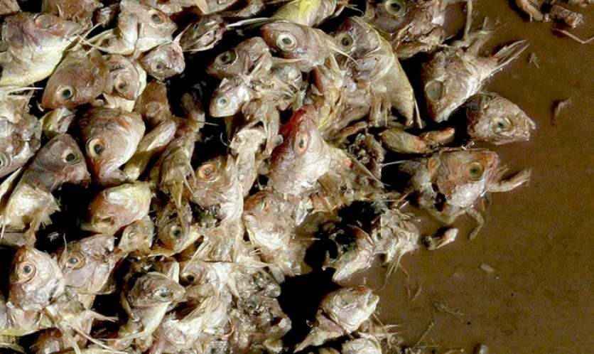
DEAD
ZONES - Fish and crabs cannot survive in oxygen depleted ocean zones.
See our vision for a sustainable world future here.
Researchers found the dead zones in eddies, large areas of swirling water, that were slowly moving westward — raising fears that the low-oxygen zones could encounter an island and potentially lead to mass fish kills in shallower water, the
research report said.
“The few eddies we observed in greater detail may be thought of as rotating cylinders of 100 to 150 km (60-94 miles) in diameter and
a height of several hundred meters, with the dead zones taking up the upper 100 meters (328 feet) or so,” Johannes Karstensen, a researcher at GEOMAR, the Helmholtz Center for Ocean Research Kiel, in Kiel,
Germany, said in a press release. Karstensen was part of the team of German and Canadian researchers behind the report.
Dead zones normally occur near coastlines where river runoff carries fertilizers and other chemical nutrients into the ocean, causing algae blooms that rapidly consume the water’s oxygen, the press release said. Though ocean currents can carry these waters away from the coast, a dead zone forming in the open ocean had not yet been discovered, according to the press release for the report, titled “Open ocean dead zones in the tropical North Atlantic Ocean.” It was published in the European Geosciences Union’s open access journal Biogeosciences.
It is unclear what caused the dead zones to form in the open ocean, the report said.

ATLANTOS
- NOV 25 2014
The largest marine science project that the European Commission has ever funded, the $31.7 million AtlantOS project, is due to start in January 2015, bringing together a wide spectrum of scientific disciplines from more than 60 research organizations across the world to enhance the efficiency of ocean observation procedures.
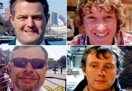
Missing yachtsmen
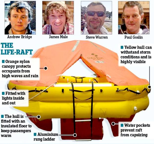
Pauls Goslin 56, James Male 23, Steve Warren 52 and Andrew Bridge 21.
One of Britain's youngest star yachtsmen is missing at sea along with three crew members after the boat they were sailing from the Caribbean is feared to have capsized in the Atlantic Ocean.
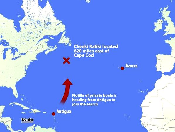
Andrew Bridge, 21, was skipper of the 12 metre (40ft) yacht Cheeki Rafiki, which ran into difficulties on Thursday on its way back to the UK from Antigua sailing week.
Contact with the vessel was lost in the early hours of Friday after it began taking on water and diverted to the Azores.
LOST
AT SEA MAY 2014
Flotilla of 40 private boats joins search for missing British yachtsman as
U.S. coastguards cave in and resume the hunt after huge petition
American authorities caved to pressure to continue searching for missing crew on
Tuesday 20th May. Nearly 200,000 people signed an online petition urging them to
restart. This came after yachts from around the world vowed to search at the boat's last known location. Prime Minister
David Cameron was quick to thank the U.S. on Twitter. The private search was described as channelling the 'Spirit of Dunkirk'
A two-day search by US and Canadian aircraft and merchant vessels covering 4,146 sq miles was called off at dawn
( 5am) on
Sunday 18th May 2014. The four men are believed to have abandoned the vessel for a
life raft.
Doug Innes, the director of the British yacht training and charter firm Stormforce Coaching, praised the extensive search efforts but said he was devastated they had been called off so soon.
Stormforce, the managing agent for the vessel, said in a statement: "The yacht Cheeki Rafiki, a Beneteau First 40.7, was on passage from the
Caribbean to the UK with a crew of four yachtsmen. On Thursday she started taking on water.
"We were in contact with the skipper and at the time the yacht and crew were keeping the situation stable. They had not been able to ascertain where the water ingress was from and were diverting to the Azores.
"Unfortunately we lost contact during the early hours of Friday morning and we believe the crew abandoned to the life raft.
"Our thoughts are with the four yachtsmen and their families and we hope and pray for them all."
Bridge's aunt, Georgina Bridge, said: "Obviously the family are really concerned that the search has been suspended and we are really hoping that it will be resumed. We are holding out great hope that Andrew and the guys on board Cheeki Rafiki will be found.
"We are hopeful that they were able to launch a life raft and that they are still on board that, so we would just really like the search to be resumed."
The US Coast Guard said a crew from the 300 metre (1,000ft) Maersk Kure had spotted an overturned hull that matched the description of the Cheeki Rafiki on Saturday, but found no sign of the sailors.
Petty Officer Rob Simpson, a spokesman for the US Coastguard, said the Maersk Kure was not designed for search and rescue. Asked if others could have attended the scene where the hull was found, he said: "It is not possible to take a helicopter that far off shore - the search area is very far out in the middle of the Atlantic Ocean. The grand scale of this is immense. Aircraft take four or five hours to get there and vessels can take over a week. This particular ship just happened to be in the area, they were not tasked specifically for this."
PO Simpson said that two beacons used by the Cheeki Rafiki crew, which he described as "about the size of a mobile phone", give off GPS coordinates of their last known location while their batteries last.
But he added: "We are not actually able to hone into them when on location with an aircraft and have stopped receiving signals from them."
In the search area there were 30 knot winds, a near gale, and between four and five metre (13ft-15ft) seas.
It is understood that the missing sailors made an initial call by satellite phone on Thursday about water on board the vessel. A second brief call four hours later said conditions were deteriorating, but gave no further information. Shortly afterwards, the US Coast Guard received a distress alert from Bridge and launched the search.
The four crew members were described as very experienced yachtsmen and Bridge, the youngest of the group, as a highly qualified skipper.
It is believed that Goslin and Warren, who were coastal skippers, had volunteered to do the transatlantic crossing.
Aged 21, Bridge had two high-level yachtmaster qualifications from the Royal Yachting Association, which meant he could skipper a yacht a minimum non-stop distance of 600 miles.
To qualify for the yachtmaster ocean certificate, a skipper must have been at sea continuously for at least 96 hours and the yacht must have been more than 50 miles from land while sailing a distance of at least 200 miles.
Bridge, nicknamed "the bear", was described as "undoubtedly one of the top bowmen in the country" in a biography on Stormforce's website. It said: "He was formerly bowman onboard Encore (First 40.7) when it won its fleet in the 2010 Round Britain & Ireland Race and was the 1st First 40.7 in the Fastnet 2009 race.
"He has won numerous RORC English channel races and has raced onboard Cheeki Rafiki with Ifan countless times, again with several podium positions to his name. Andy is a yachtmaster offshore and keelboat instructor."
The 21-year-old is believed to have competed in the Royal Ocean Racing Club Caribbean 600 event in Antigua in February this year, taking the role of first mate on the Cheeki Rafiki for the four-day race involving 60 boats.
Writing on the Stormforce website, a fellow crew member who was on board the Cheeki Rafiki described how an "electrical issue nobody could have foreseen" wiped out the vessel's sailing instruments and how they were stuck for four hours in a wind hole off the French Caribbean islands of Guadeloupe.
A Foreign Office spokeswoman said: "We are aware of a missing yacht off the east coast of the US with four British nationals on board.
"We are in contact with the US Coast Guard and have offered consular assistance to the families."
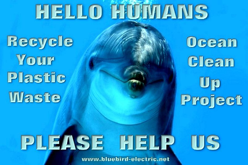
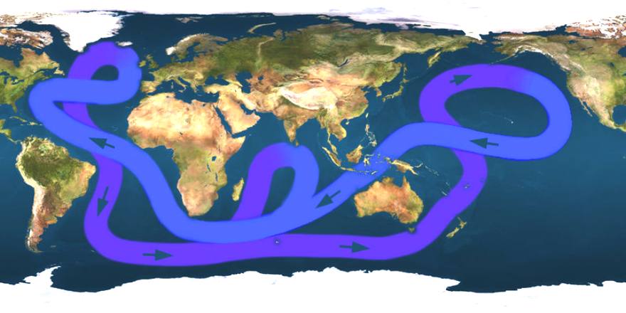
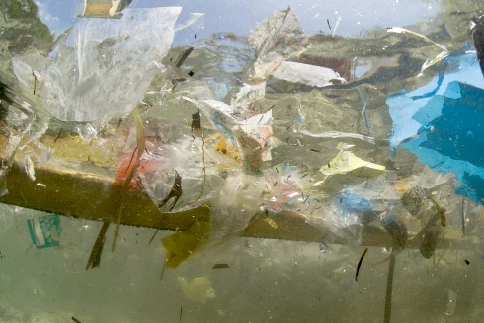
Oil
and plastic
pollution totaling some 270,000 tons of waste in five major ocean
gyres, is killing life in the oceans and poisoning our food chain. Dolphins,
Seals and Turtles that have been trapped by plastic bags, nets and the
like are common sights. These animals cannot clean the oceans up
themselves. They need the help of the humans that caused the problem,
turning their
habitat into a convenient 'out of sight' rubbish dump.
Adapted
Bluefish
ZCC semi-autonomous drones could clean up the oceans for us in just a
decade, if funding can be sourced to kickstart such a challenging project.
Bluebird Marine Systems are not fund raising for the proposed clean-up
project, rather leaving this to those better qualified. BMS are though
able to develop prototypes in-house to be able to prove concepts, and
arrange for subcontractors to build ocean going cleaners that do not add
to the carnage, because they are themselves zero emission, solar and wind
powered high performance vehicles. We are prepared to work on research projects
such as these on a not-for-profit
basis in collaboration with other agencies
and organizations.
THE
ATLANTIC
The Atlantic Ocean is the second-largest of the world's oceanic divisions. With a total area of about 106,400,000 square kilometres (41,100,000 sq
mi), it covers approximately 20 percent of the Earth's surface and about 29 percent of its water surface area. The first part of its name refers to Atlas of Greek mythology, making the Atlantic the "Sea of Atlas".
The oldest known mention of "Atlantic" is in The Histories of Herodotus around 450 BC (Hdt. 1.202.4): Atlantis thalassa
(English: Sea of Atlas). The term Ethiopic Ocean, derived from Ethiopia, was applied to the southern Atlantic as late as the mid-19th
century. Before Europeans discovered other oceans, the term "ocean" itself was synonymous with the waters beyond the Strait of Gibraltar that we now know as the Atlantic. The early Greeks believed this ocean to be a gigantic river encircling the world.
The Atlantic Ocean occupies an elongated, S-shaped basin extending longitudinally between Eurasia and Africa to the east, and the Americas to the west. As one component of the interconnected global ocean, it is connected in the north to the Arctic Ocean, to the Pacific Ocean in the southwest, the Indian Ocean in the southeast, and the Southern Ocean in the south (other definitions describe the Atlantic as extending southward to Antarctica). The equator subdivides it into the North Atlantic Ocean and South Atlantic Ocean.
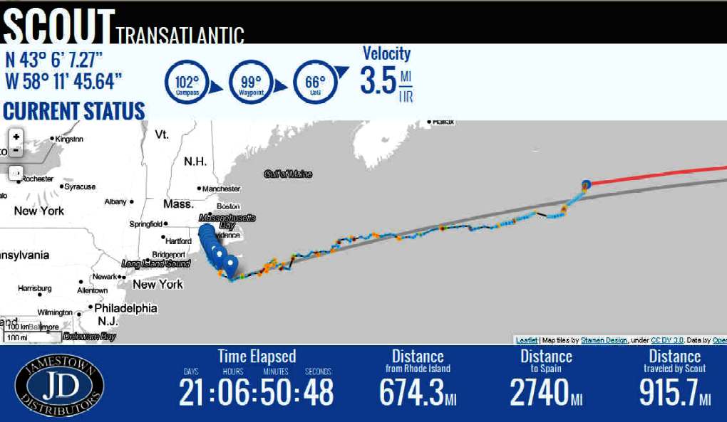
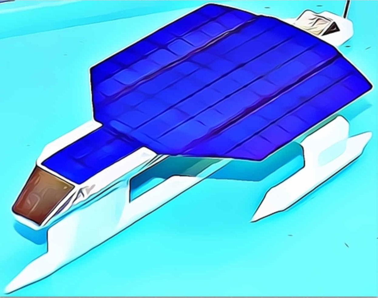
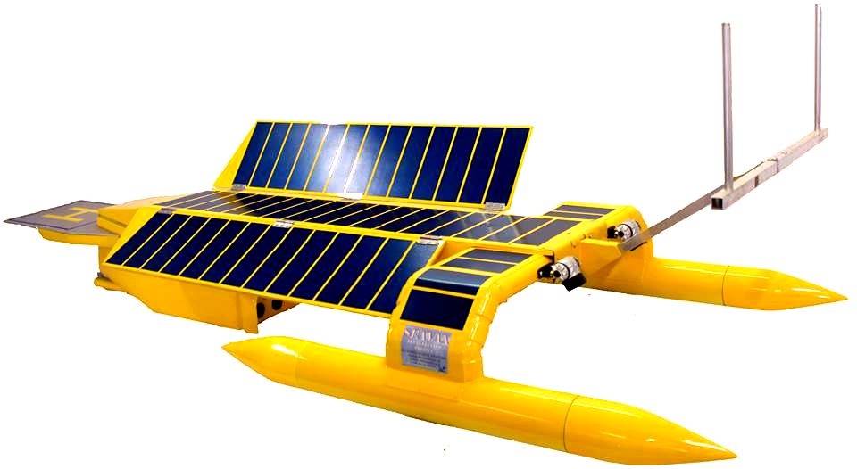
SCOUT
TRANSATLANTIC - An
attempt by a group of students from Tiverton, New England, to cross the
Atlantic with an unmanned, solar powered boat. As the screen capture above
reveals, they already have the the World record, previously 60 miles, set
in 2010.
SEAWATER
CHARACTERISTICS
On average, the Atlantic is the saltiest major ocean; surface water salinity in the open ocean ranges from 33 to 37 parts per thousand (3.3 – 3.7%) by mass and varies with latitude and season. Evaporation, precipitation, river inflow and sea ice melting influence surface salinity values. Although the lowest salinity values are just north of the equator (because of heavy tropical rainfall), in general the lowest values are in the high latitudes and along coasts where large rivers enter. Maximum salinity values occur at about 25° north and south, in subtropical regions with low rainfall and high evaporation.
Surface water temperatures, which vary with latitude, current systems, and season and reflect the latitudinal distribution of solar energy, range from below −2 °C (28 °F). Maximum temperatures occur north of the equator, and minimum values are found in the polar regions. In the middle latitudes, the area of maximum temperature variations, values may vary by 7–8 °C (12–15°F).
The Atlantic Ocean consists of four major water masses. The North and South Atlantic central waters make up the surface. The sub-Antarctic intermediate water extends to depths of 1,000 metres (550 fathoms; 3,300 ft). The North Atlantic Deep Water reaches depths of as much as 4,000 metres (2,200 fathoms; 13,000 ft). The Antarctic Bottom Water occupies ocean basins at depths greater than 4,000 metres.
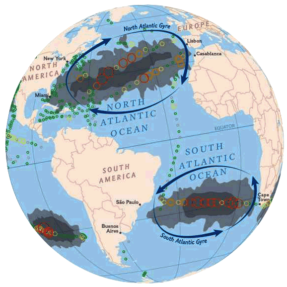
Within the North Atlantic, ocean currents isolate the Sargasso Sea, a large elongated body of water, with above average salinity. The Sargasso Sea contains large amounts of seaweed and is also the spawning ground for both the European eel and the American eel.
The Coriolis effect circulates North Atlantic water in a clockwise direction, whereas South Atlantic water circulates counter-clockwise. The south tides in the Atlantic Ocean are semi-diurnal; that is, two high tides occur during each 24 lunar hours. In latitudes above 40° North some east-west oscillation occurs.
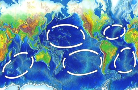
PLASTIC
ZONES - Along with the other three gyres, the north and south Atlantic
ocean gyres are additional regions where fish are not in healthy
waters.
GEOGRAPHY
The Atlantic Ocean is bounded on the west by North and South America. It connects to the Arctic Ocean through the Denmark Strait, Greenland Sea, Norwegian Sea and Barents Sea. To the east, the boundaries of the ocean proper are Europe; the Strait of Gibraltar (where it connects with the Mediterranean Sea–one of its marginal seas–and, in turn, the Black Sea, both of which also touch upon Asia) and Africa.
In the southeast, the Atlantic merges into the Indian Ocean. The 20° East meridian, running south from Cape Agulhas to Antarctica defines its border. Some authorities show it extending south to Antarctica, while others show it bounded at the 60° parallel by the Southern Ocean.
In the southwest, the Drake Passage connects it to the Pacific Ocean. The man-made Panama Canal links the Atlantic and Pacific. Besides those mentioned, other large bodies of water adjacent to the Atlantic are the Caribbean Sea; the Gulf of Mexico; Hudson Bay; the Arctic Ocean; the Mediterranean Sea; the North Sea; the Baltic Sea and the Celtic Sea.
Covering approximately 22% of Earth's surface, the Atlantic is second in size to the Pacific. With its adjacent seas, it occupies an area of about 106,400,000 square kilometres (41,100,000 sq mi); without them, it has an area of 82,400,000 square kilometres (31,800,000 sq mi). The land that drains into the Atlantic covers four times that of either the Pacific or Indian oceans. The volume of the Atlantic with its adjacent seas is 354,700,000 cubic kilometers (85,100,000 cu mi) and without them 323,600,000 cubic kilometres (77,640,000 cu mi).
The average depth of the Atlantic, with its adjacent seas, is 3,339 metres (1,826 fathoms; 10,950 ft); without them it is 3,926 metres (2,147 fathoms; 12,880 ft). The greatest depth, Milwaukee Deep with 8,380 metres (4,580 fathoms; 27,500 ft), is in the Puerto Rico Trench. The Atlantic's width varies from 1,538 nautical miles (2,848 km; 1,770 mi) between Brazil and Sierra Leone to over 3,450 nautical miles (6,400 km; 4,000 mi) in the south.
HISTORY
The Atlantic Ocean appears to be the second youngest of the five oceans. It did not exist prior to 130 million years ago, when the continents that formed from the breakup of the ancestral super continent Pangaea were drifting apart from seafloor spreading. The Atlantic has been extensively explored since the earliest settlements along its shores.
The Vikings, the Portuguese, and the Spaniards were the most famous among early explorers. After Columbus, European exploration rapidly accelerated, and many new trade routes were established.
As a result, the Atlantic became and remains the major artery between Europe and the Americas (known as transatlantic trade). Scientific explorations include the Challenger expedition, the German Meteor expedition, Columbia University's Lamont-Doherty Earth Observatory and the United States Navy Hydrographic Office.
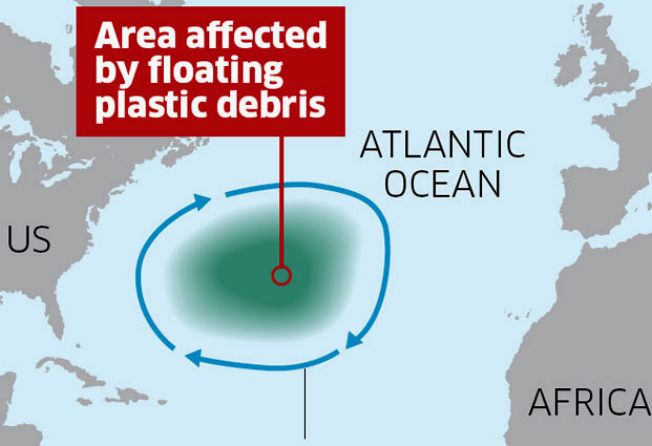
PLASTIC
- AUGUST 2010, THE INDEPENDENT
A huge expanse of floating plastic debris has been documented for the first time in the North Atlantic Ocean. The size of the affected area rivals the "great Pacific garbage patch" in the world's other great ocean basin, which generated an outcry over the effects of plastic waste on marine wildlife.
The new plastic waste, which was discovered in an area of the Atlantic to the east of Bermuda, consists mostly of fragments no bigger than a few millimetres wide. But their concentrations and the area of the sea that is covered have caused consternation among marine biologists studying the phenomenon.
Using fine-mesh nets towed from a research ship, the scientists collected more than 64,000 individual plastic pieces at 6,100 locations out at sea over the 22-year period of the survey. The highest concentrations were centred at approximately the same latitude as Atlanta, Georgia (32 degrees North) but extended about 500 miles north and south of this line.
Kara Lavender Law from the Sea Education Association in Woods Hole, Massachusetts, said the size of the Atlantic "garbage patch" was roughly equal to the one in the Pacific, where circulating currents of the North Pacific Gyre have trapped it over a wide area to the north of the equator.
"The Pacific has received more attention in terms of plastic accumulation but we know less about the Pacific so it's very difficult to compare the Atlantic patch in terms of size. We had a cruise this summer to try to find the eastern extent and in fact we failed to find it," Dr Lavender Law said.
"East of Bermuda we had no evidence of a decrease in concentration so we still haven't answered the question. All we can say is the highest concentrations between the two oceans are comparable. My guess is they are similar-sized problems," she said.
"For the first time we've been able to put north-south bounds on the region of plastic accumulation. We've presented the most extensive dataset on plastic marine debris on any ocean basin," she added. The nets have a mesh size of 0.3mm, so the survey has only collected fragments bigger than this size. "Most pieces are smaller than the eraser on the top of your pencil. These are fragments from larger objects but we cannot say which objects they are from or where they originated," Dr Lavender Law said.
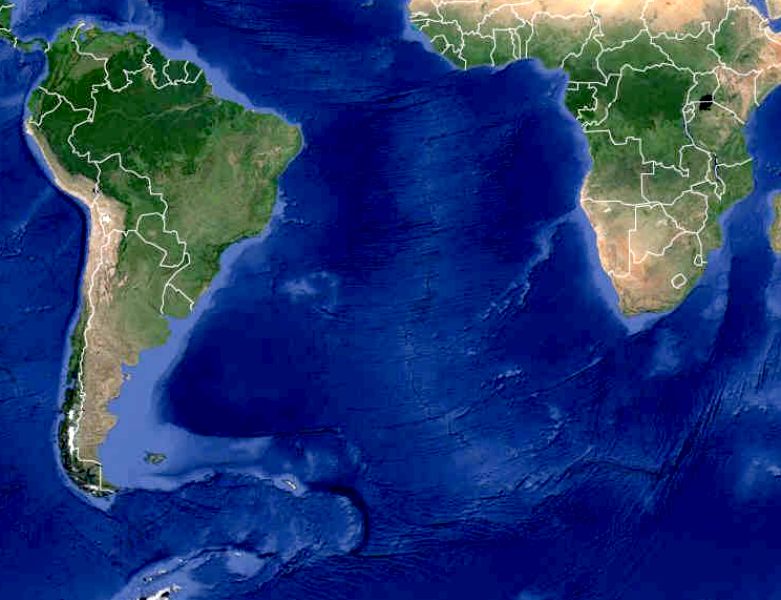
MAP -
South Atlantic Ocean
Most of the plastic appears to be polyethylene or polypropylene, which are less dense than seawater and float near to the surface. However, other kinds of denser plastic debris may have sunk to the bottom of the ocean where it has disappeared from view.
The study, published in the journal Science, found that the concentration of plastic particles caught in the nets since the survey began in 1986 has remained remarkably constant – but Dr Lavender Law emphasised that this did not mean the problem was manageable. "It does seem constant but we have to be careful about the interpretation that it is not getting worse, because what we are measuring is plastic larger than a third of a millimetre in size floating at the surface," she said.
"One explanation is that the pieces are becoming small enough to pass straight through the net. The plastic may still be floating at the ocean surface – it's just that we are not collecting it once it's smaller than a particular size.
"Another explanation is that we've found evidence that biological growth on pieces of plastic actually makes them denser and it's possible that, over time, if there is enough biological growth they may become dense enough to sink from the surface, where we wouldn't collect it," she explained.
Small fragments of plastic could pose an even greater menace to marine life than the larger fragments that become entangled with animals such as albatrosses and
turtles, she said. "We know that smaller pieces of plastic are eaten and it's unclear what happens to that plastic then. But clearly biological organisms were not designed to eat plastic," she said.
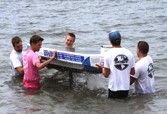
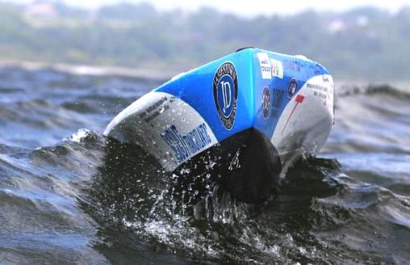
The
Scout team launch their hi-tech robot machine into the Atlantic at Rhode
Island.
NOTABLE ATLANTIC CROSSINGS
Around 980 – 982, Erik the Red discovered Greenland, geographically and geologically a part of the Americas.
In the year 1000, the Icelander Leif Ericson was the first European to set foot on North American soil, corresponding to today's Eastern coast of Canada, i. e. the province of Newfoundland and Labrador, including the area of land named "Vinland" by Ericson. The Norse discovery was documented in the 13th century Icelandic Sagas and was corroborated by recent L'Anse aux Meadows archeological evidence.
Around 1010, Thorfinnr Karlsefni led an attempted Viking settlement in North America with 160 settlers, but was later driven off by the natives. His son Snorri Thorfinnsson was the first American born (somewhere between 1010 and 1013) to European (Icelandic) immigrant parents.
In 1419 and 1427, Portuguese navigators reached Madeira and Azores, respectively.
From 1415 to 1488, Portuguese navigators sailed along the Western African coast, reaching the Cape of Good Hope.
In 1492, Christopher Columbus landed on the island of San Salvador in The Bahamas.
In 1500, Pedro Álvares Cabral reached Brazil.
In 1524, Florentine explorer Giovanni da Verrazzano, in the service of the King Francis I of France, discovered the United States of America's east coast.
In 1534, Jacques Cartier entered the Gulf of St. Lawrence and reached the mouth of the St. Lawrence River.
In 1764, William Harrison (the son of John
Harrison) sailed aboard the HMS Tartar, with the H-4 time piece. The voyage became the basis for the invention of the global system of
Longitude.
In 1858, Cyrus West Field laid the first transatlantic telegraph cable (it quickly failed).
In 1865, Brunel's ship the SS Great Eastern laid the first successful transatlantic telegraph cable.
In 1870, the small City of Ragusa (Dubrovnik) became the first small Lifeboat to cross the Atlantic from Cork to Boston with two men crew, John Charles Buckley and Nikola Primorac (di Costa), only.
In 1896, Frank Samuelsen and George Harbo from Norway became the first people to ever row across the Atlantic Ocean.
On April 15, 1912 the RMS Titanic sank after hitting an iceberg with a loss of more than 1,500 lives.
1914–1918, the First Battle of the Atlantic took place.
In 1919, the American NC-4 became the first seaplane to cross the Atlantic (though it made a couple of landings on islands and the sea along the way, and taxied several hundred miles).
Later in 1919, a British aeroplane piloted by Alcock and Brown made the first non-stop transatlantic flight, from Newfoundland to Ireland.
In 1921, the British were the first to cross the North Atlantic in an airship.
In 1922, Portuguese aviators Sacadura Cabral and Gago Coutinho were the First aerial crossing of the South Atlantic on a seaplane connecting Lisbon to Rio de Janeiro.
In 1927, Charles Lindbergh made the first solo non-stop transatlantic flight in an aircraft (between New York City and Paris).
In 1931, Bert Hinkler made the first solo non-stop transatlantic flight across the South Atlantic in an aircraft.
In 1932, Amelia Earhart became the first female to make a solo flight across the Atlantic
1939–1945, the Second Battle of the Atlantic. Nearly 3,700 Allied ships were sunk at a cost of 783 German U-boats.
In 1952, Ann Davison was the first woman to single-handedly sail the Atlantic Ocean.
In 1965, Robert Manry crossed the Atlantic from the U.S. to England non-stop in a 13.5 foot (4.05 meters) sailboat named "Tinkerbell". Several others also crossed the Atlantic in very small sailboats in the 1960s, none of them non-stop, though.
In 1969 and 1970 Thor Heyerdahl launched expeditions to cross the Atlantic in boats built from papyrus. He succeeded in crossing the Atlantic from Morocco to Barbados after a two-month voyage of 6,100 km with Ra II in 1970, thus conclusively proving that boats such as the Ra could have sailed with the Canary Current across the Atlantic in prehistoric times.
In 1980, Gérard d'Aboville was the first man to cross the Atlantic Ocean rowing solo.
In 1984, Amyr Klink crossed the south atlantic rowing solo from Namibia to Brazil in 100 days.
In 1984, five Argentines sail in a 10-meter-long raft made from tree trunks named Atlantis from Canary Islands and after 52 days 3,000 miles (4,800 km) journey arrived to Venezuela in an attempt to prove travelers from Africa may have crossed the Atlantic before
Christopher
Columbus.
In 1994, Guy Delage was the first man to allegedly swim across the Atlantic Ocean (with the help of a kick board, from Cape Verde to Barbados).
In 1998, Benoît Lecomte was the first man to swim across the northern Atlantic Ocean without a kick board, stopping for only one week in the Azores.
In 1999, after rowing for 81 days and 4,767 kilometres (2,962 mi), Tori Murden became the first woman to cross the Atlantic Ocean by rowboat alone when she reached Guadeloupe from the Canary Islands.
FICTIONAL
CROSSINGS
John
Storm is the captain of the Elizabeth
Swann, a solar/hydrogen hybrid that enables rapid Atlantic transits,
with zero
emissions. In the adventure: Cleopatra
The Mummy, he and his crew have to travel across the pond twice. North to
South, to the Amazon,
and South to North, back to the Mediterranean, to Thonis-Alexandria.
The
Atlantic Oceans world location map
ACIDIFICATION
- ADRIATIC - AEGEAN
- ARCTIC
- ATLANTIC - BALTIC
- BAY BENGAL - BAY
BISCAY - BERING
- BLACK - CARIBBEAN - CORAL
- EAST CHINA - ENGLISH
CH -
FINLAND - GOC
- GULF GUINEA - GULF
MEXICO - GULF THAILAND - GULF
TONKIN - HORMUZ -
INDIAN -
IONIAN
- IOC
-
IRC
- IRISH
- MEDITERRANEAN - NORTH
SEA - PACIFIC - PERSIAN
GULF
RED
SEA
- SEA JAPAN
- STH
CHINA - PLASTIC
- PLANKTON - PLASTIC
OCEANS - RED - SARGASSO
- SEA
LEVEL RISE - SOUTHERN
OCEAN - TYRRHENIAN
- TAIWAN - UNCLOS
- UNEP
WOC
- WWF
AMAZON
- BURIGANGA - CITARUM -
CONGO -
CUYAHOGA
-
GANGES - IRTYSH
- JORDAN -
LENA -
MANTANZA-RIACHUELO
MARILAO
- MEKONG -
MISSISSIPPI -
NIGER -
NILE -
PARANA -
PASIG -
SARNO - THAMES
- YAMUNA -
YANGTZE -
YELLOW -
ZHUJIANG
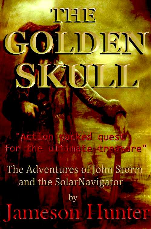
LORD
HUNTINGTON - a prominent member of the British Geographical Society, acquires an ancient parchment on the deathbed of a famous explorer, handed down through
generations, father to son, which contains clues to the location of pirate,
Henry
Morgan's accumulated treasure trove on an Island in the Caribbean, said to be guarded by a macabre human spirit manifesting itself as human skull. More to the point these islands are patrolled by the US and South American navies who are in a cold war situation.
Huntington hires John Storm for his expertise in marine archaeology as a consultant to the expedition and the
Elizabeth Swan, a solar powered ship, for its stealth cloaking ability making the boat invisible to radar.
They find the Island avoiding contact with any of the Bolivarian Republic's (of Venezuela) warships which might arouse curiosities but despite all efforts to keep the reason for the expedition a secret, the word is leaked out by a one of Huntington's arch rivals to a corrupt naval officer, who engages a cutthroat gang of mercenaries to steal the treasure and glory for himself.
The treacherous rival gang soon invades the Island intent on getting the treasure for themselves, having first sabotaged the
Elizabeth Swan .......... or so they thought ....


LINKS
& REFERENCE
http://www.independent.co.uk/news/science/now-atlantic-is-found-to-have-huge-garbage-patch-2057402.html Wikipedia
North_Atlantic_garbage_patch
Spirit-Dunkirk
spirit as 40 private boats search for British sailors in the Atlantic
after US Coastguard quits
Wikipedia
Atlantic_Ocean EQU
news
dead zones found in atlantic open waters
The
Guardian 2015 February coastal communities dumping 8 million tonnes of
plastic in oceans every year Swim
The Big Blue https://ec.europa.eu/easme/en/news/dont-mis-4th-atlantic-stakeholder-platform-conference-8-november-2017-glasgow http://www.pbs.org/newshour/author/robertsd/ http://www.pbs.org/newshour/rundown/spacex-pulls-off-first-successful-mid-ocean-rocket-landing/ http://www.thetransat.com https://sharkshield.com/ http://www.swimthebigblue.com/ http://www.theguardian.com/science/2015/feb/12/coastal-communities-dumping-8m-tonnes-of-plastic-in-oceans-every-year http://www.independent.co.uk/news/science/now-atlantic-is-found-to-have-huge-garbage-patch-2057402.html https://en.wikipedia.org/wiki/North_Atlantic_garbage_patch
https://en.wikipedia.org/wiki/Atlantic_Ocean
http://www.egu.eu/news/165/dead-zones-found-in-atlantic-open-waters/
http://www.telegraph.co.uk/news/uknews/10843975/US-coastguard-to-renew-search-for-missing-yachtsmen.html
http://www.theguardian.com/uk-news/2014/may/18/four-british-yachtsmen-missing-atlantic?CMP=EMCNEWEML6619I2
http://www.enterprise-europe-scotland.com/sct/news/?newsid=4538
http://en.wikipedia.org/wiki/International_Convention_for_the_Safety_of_Life_at_Sea
SEAVOLUTION
- This robot
ship uses no diesel fuel to trawl the oceans autonomously (COLREGS
compliant) 24/7 and 365 days a year - only possible with the revolutionary (patent) energy harvesting system.
The proposed SeaVax vessel is designed to suck up
plastic waste, so cleaning the massive swirling gyres of toxins, and even
ghost fishing nets.
International development partners are welcome. Contact
us to join in the big cleanup.
|