|
Location
map of the Adriatic Sea
Increased human use of the marine and coastal space, in particular for
fishing, maritime transport, tourism, and construction, has intensified pressures on coastal and marine ecosystems. Ecosystem based approach to coordination of activities is needed within the framework of Integrated Coastal Management (ICM) and Marine Spatial Planning (MSP) in order to ensure sustainable use of resources. Both frameworks are important stimulants for cross-border collaboration and stakeholder cooperation across different coastal and maritime sector activities, and have potential for bringing together ecosystem services and
Blue Growth opportunities in a sustainable way.
EU
COMMISSION BLUE GROWTH STRATEGY
The European Commission
launched a EU Strategy for the Adriatic and Ionian Region on 17 June 2014.
The strategy mainly revolves around the opportunities of the maritime economy - 'blue growth', land-sea transport, energy connectivity, protecting the marine environment and promoting sustainable tourism – sectors that are bound to play a crucial role in creating jobs and boosting economic growth in the region. The starting point for this is the Maritime Strategy for the Adriatic and Ionian Seas, adopted by the Commission on 30 November 2012 and now incorporated into the Strategy.
This is the first EU 'macro-regional strategy' with such a large proportion of non-EU countries (Albania, Bosnia and Herzegovina, Montenegro and Serbia) cooperating with EU countries (Croatia, Greece, Italy, and Slovenia). A pair of countries – one EU country and one non-EU country- coordinated the development of each element of the Action Plan:
1. Greece and Montenegro on "Blue
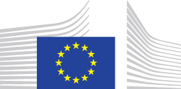
Growth": this pillar intends to drive innovative maritime and marine growth in the Region, by promoting sustainable economic development and jobs, and business opportunities in the Blue economy.
2. Italy and Serbia on "Connecting the Region" (transport and energy networks): this pillar aims to improve transport and energy connectivity in the Region and with the rest of
Europe.
3. Slovenia and Bosnia and Herzegovina on "Environmental Quality": this pillar addresses environmental quality through better cooperation at the level of the Region
4. Croatia and Albania on "Sustainable Tourism": this pillar aims to develop the full potential of the Region in terms of innovative, sustainable, responsible and quality tourism.
In addition, capacity building as well as research, innovation and small and medium size business are cross-cutting aspects.
Climate change mitigation and adaptation as well as disaster risk management are horizontal principles relevant to all four pillars.
Background
The maritime strategy for the Adriatic and Ionian Seas (2012) assesses the needs and potential of sea-related activities and sets out a framework for coordinated efforts by all maritime stakeholders aiming at:
* a thriving maritime economy that provides growth and job opportunities;
* a healthier marine environment;
* a safer and more secure maritime space;
* sustainable and more responsible fisheries activities.
These objectives constitute the four priority areas of the strategy and are resulted from extensive stakeholder consultations held in 2012 (stakeholder workshops (1:
Athens 2: Trieste and 3: Portoroz). These objectives and the proposed actions were discussed at the stakeholder conference “Setting an Agenda for Smart, Sustainable and Inclusive Growth from the Adriatic and Ionian Seas" (Zagreb, Croatia, 6 December 2012).
BLUE
GROWTH Q & A -
on the EU Strategy for the Adriatic and Ionian Region (EUSAIR)
Why do we need an EU Strategy for the Adriatic and Ionian Region?
The Region faces several challenges which will be tackled more successfully together than on a purely national or local level. Striking socio-economic disparities (e.g. in terms of GDP per capita and unemployment rates); a lack of research-to-business networks; shortcomings in transport links (road, rail and air) and vessel traffic congestion; inadequate interconnections of
electricity grids; unsustainability of fisheries; environmental threats such as
marine
pollution, the preservation of a highly diverse marine environment and the adverse effects of climate change (in the form of rising sea levels, flooding, drought, soil erosion and forest fires);and insufficient institutional and administrative capacity.
But there are also some promising opportunities that can be capitalized on, including: the
Blue economy - notably sustainable seafood production and consumption, maritime, coastal and cruise tourism as well as innovative blue technologies; or the potential for improved land-sea connectivity and intermodal transportation to increase the competitiveness of hinterland economies. The Region is one of outstanding natural beauty and rich cultural, historic and archaeological heritage with potential for sustainable, responsible and diversified
tourism.
Better coordination and cooperation between the countries and regions concerned is needed to address shared challenges and better exploit opportunities. On this basis, the European Council of December 2012 requested the European Commission to present a new macro-regional strategy for the Adriatic and Ionian Region before the end of 2014.
Which countries are involved in the Strategy?
The Region is a functional area primarily (but not exclusively) defined by the Adriatic and Ionian Sea basin. Home to more than 70 million people, the Region plays a key role in strengthening geographical continuity in Europe.
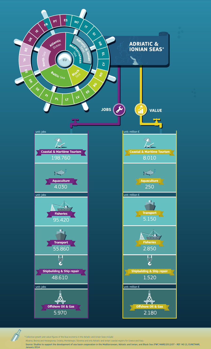
In its current shape, the Strategy builds on the Adriatic-Ionian Initiative1, which concerns eight countries: four EU Member States (Croatia, Greece, Italy, Slovenia) and four non-EU countries (Albania, Bosnia and Herzegovina, Montenegro, Serbia).
Will it be open to other countries?
The Strategy remains open to other partners in the Region.
Why does the EU need to be involved in this? Where is the added value?
The EU is in a good position to facilitate and coordinate cooperation, especially in the Strategy's initial phase. However, leadership of the Strategy should come from the countries and regions involved themselves.
Involvement of the EU will facilitate a cross-sector approach consistent with different EU policies. It will highlight possible complementarities and synergies between policies and programmes currently carried out in the Region. It will help aligning and mobilising the wide range of funds and programmes currently available in the Region to support the achievement of the Strategy's goals.
There is already a wealth of experience in this area: the existing Maritime Strategy for the Adriatic and Ionian Seas is an integral part of this new broader macro-regional strategy. The new Strategy can build on the lessons learnt from the other two current macro-regional strategies (EU Strategy for the Baltic Sea Region, EU Strategy for the Danube Region). In this context, the involvement of the EU can also lead to synergies between the EUSAIR and the other macro-regional strategies, in particular with the Danube Strategy which includes five EUSAIR countries and addresses transport, energy and the environment as key fields of action.
See also: the Report on the added value of the macro-regional Strategies (June 2013)
What are the main objectives of the Strategy?
The two general objectives of the EUSAIR are: to promote sustainable economic and social prosperity of the Region through growth and jobs creation, by improving its attractiveness, competitiveness and connectivity, while preserving the environment and ensuring a healthy and balanced marine and coastal ecosystems.
And crucially, to contribute to the EU integration of the participating Western Balkan candidate and potential candidate countries, by bringing together countries with much shared history and geography.
The idea is to identify concrete joint priorities for the macro-region, making the best use of existing institutions, policies and funds and setting realistic goals for maximum impact.
What areas will it cover?
The following four themes/pillars have been identified:
Blue Growth, aiming at boosting innovative marine and maritime growth by promoting jobs and business opportunities in the Blue economy;
Connecting the Region, aiming at improving connectivity in terms of transport and energy;
Environmental quality, focusing on coastal and marine biodiversity and pollution of the sea, as well as on transnational terrestrial habitats and biodiversity; and
Sustainable Tourism, aiming at developing the full potential of the Region in terms of innovative quality tourism while boosting businesses and creating stable jobs
Capacity building –including communication-, research & innovation and SMEs development are cross-cutting aspects, whereas due account is to be taken of mitigation of and adaptation to climate change effects as well as of efficient disaster risk management (including prevention) as horizontal principles underpinning all actions carried out under the four pillars.
On what basis were the four themes selected?
The four themes were first identified in meetings of the Foreign Ministers of the participating countries with Commissioner Hahn in November 2012. From September to December 2013, a stakeholders’ consultation was held across the Region on the content of the future Action Plan of the Strategy, with the aim of reflecting the real needs of the inhabitants of the area. The contributions gathered were further discussed at a Stakeholder Conference of the EU Strategy for the Adriatic and Ionian Region, jointly organised in Athens on 6-7 February 2014 by the Greek Presidency of the Council of the European Union and the European Commission.
What exactly is the relationship between the Maritime Strategy and this new one?
The EU Strategy for the Adriatic-Ionian Region largely builds on the Maritime Strategy for the Adriatic and Ionian Seas adopted on 30 November 2012. It shares the same geography, many challenges and main growth and jobs opportunities, and adds a new dimension of cooperation between partners on the coastal hinterland.
Maritime and marine issues are fully mainstreamed into the four pillars of the EUSAIR, notably with reference to: Research & Innovation on blue economy and maritime clusters; sustainability of fisheries; diversification and sustainability of aquaculture; maritime governance; marine knowledge, biodiversity and Marine Protected Areas; pollution of sea (eutrophication, marine litter and major oil spills); maritime traffic congestion; surveillance and short-sea and deep-sea shipping; island connectivity; maritime and coastal tourism sustainability and seasonality. Strong emphasis is also given to building capacity in candidate and potential candidate countries so as to progressively comply with EU rules and standards such as the Common Fisheries Policy, the Marine Strategy Framework Directive and Maritime Spatial Planning Directive.
What are the concrete benefits for the Adriatic and
Ionian Region?
The strategy builds on existing initiatives and proposes new ones designed to:
Ensure the sustainable use of sea and coasts and the coexistence of different economic activities by making 100% of the waters under national jurisdiction subject to Maritime Spatial Planning and 100% of the coast lines subject to Integrated Coastal Management;
Improve the sustainability of fisheries by adopting and implementing multiannual fisheries management plans at sea-basin level for all threatened stocks;
Increase safety and security at sea by monitoring maritime traffic through a single shared system and a joint contingency plan for oil spills and other large-scale pollution event;
Minimise eutrophication and improve the quality of the sea water by reducing marine litter, nutrient flows and other pollutants;
Protect biodiversity by covering at least 10% of the Adriatic and Ionian Seas with Marine Protected Areas;
Facilitate nautical and cruise tourism through mutual recognition of nautical licenses and easier visa procedures between countries.
Increase off-season arrivals by 50% to even out and sustainably manage yearly tourist flows.
Who can benefit from the Strategy?
All macro-regional stakeholders can benefit from the Strategy, including: local, regional and national administrations, universities, clusters, SMEs, civil society organisations and associations, private partners, and international investors. And, above all, the citizens living in the Region.
How will the Strategy be paid for?
Although the Strategy does not come with extra EU financing, the EUSAIR will mobilise and bring together existing EU and national funding instruments.
In particular the European Structural and Investment Funds (ESIF) as well as the Instrument for Pre-accession Assistance (IPA) for 2014-2020, provide significant financial resources and a wide range of tools and technical options.
EU Funds and programmes of relevance for the specific pillar to be covered include, inter alia:
The European Maritime and Fisheries Fund and Horizon 2020, which targets Blue Growth as one of its focus areas for RTD, can lend key support to the implementation of actions and projects under the theme Blue Growth.
For Connecting the Region the Connecting Europe Facility (CEF) 2014-2020 supports the development of high-performing, sustainable and efficiently interconnected trans-European networks in the field of transport, energy and digital services.
For the Environmental quality, funds under the EU's LIFE programme, which are also open to non-EU Member States.
Sustainable Tourism can benefit from the EU's COSME programme for Small and Medium Sized Business.
Other finance is also available, notably from the Western Balkans Investment Framework, the European Investment Bank (EIB) and other International Financial Institutions. These funds and instruments should create significant leverage and attract further funding from private investors.
How will the Strategy be implemented? Who does what?
Experience with existing macro-regional strategies shows that good and stable governance is crucial to get the most out of this kind of cooperation. The recent Commission’s Report on governance of Macro-Regional Strategies of 20 May 2014 identifies two main needs in order to bring clearer results and greater impact: stronger political leadership and effective decision-making, and greater clarity and better organisation for day-to-day actions.
The Report clearly places the onus on participating countries themselves to take the prime responsibility for ensuring that the Strategy and its accompanying Action Plan are implemented in practice.
A pair of countries – one EU Member State and one non-EU country - coordinated the development of the Action Plan for each pillar:
Greece and Montenegro on "Blue
Growth",
Italy and Serbia on "Connecting the Region"
Slovenia and Bosnia and Herzegovina on "Environmental Quality",
Croatia and Albania on "Sustainable Tourism".
Effective and straightforward governance structures will be put in place as soon as the Strategy is endorsed by the Council.
Technical and operational tasks will be supported by the future Adriatic-Ionian transnational cooperation programme under European Territorial Cooperation goal.
What is the role of the Commission?
The Commission will act as a facilitator to the process of developing and implementing a coherent Strategy for the Region. This entails offering strategic support by identifying shortcomings that need to be addressed at political level, as well as suggesting resolution of implementation stalemates. It should ensure coherence, notably through mainstreaming of the macro-regional approach into EU policies and funds. The Commission will also liaise as appropriate with existing institutions (e.g. the EIB) that can deliver an important contribution to the implementation of the Action Plan.
What are the next steps?
The Communication and the accompanying Action Plan are transmitted to the European Parliament, the Council, the Committee of the Regions and the European Economic and Social Committee. After endorsement by the European Council, expected during the second half of 2014, the implementation of the Strategy can start. However, the mainstreaming of the Strategy into the Operational Programmes for the European Structural and Investment Funds and for the Instrument for Pre-accession Assistance for 2014-2020 is already taking place.
YACHT
CHARTER - The new maritime strategy for the Adriatic as well as Ionian Seas has been launched by the European Commission. This will strengthen smart, sustainable and inclusive growth in the region.
The strategy rests on 4 pillars: a stronger blue economy, a healthier marine environment, a safer maritime space, and responsible fishing activities. It builds on the Commission’s Blue Growth initiative and on the “Limassol Declaration on a marine and maritime agenda for growth and jobs”, recently adopted by EU Ministers. The vision behind the initiative: making the sea a central space of innovation, economic opportunities and prosperity for all the countries around it.
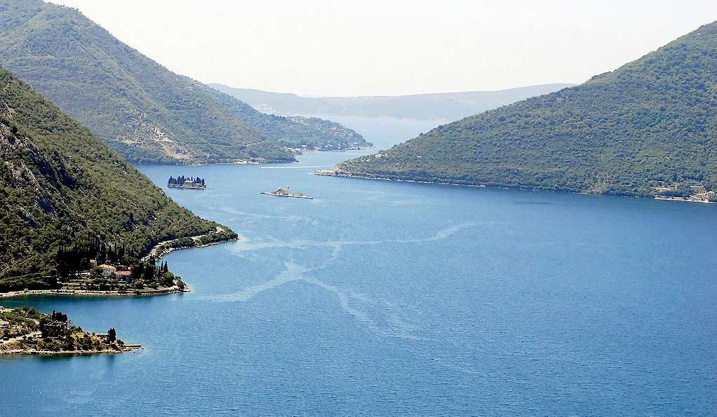
The Adriatic Sea and the contiguous Ionian Sea are an important maritime and marine area in Europe, though quite diverse in economic, environmental and cultural terms. Economic and social interactions between countries and regions have been historically dense, and are now made even stronger by the EU accession process of Western Balkan countries.
The existing maritime links, however, do not fulfil the mobility needs of citizens, businesses and tourists. And despite the rich maritime tradition and knowledge, innovation is driving the maritime economy only slowly forward. Furthermore, marine and coastal ecosystems face numerous environmental challenges as well as increasing urbanisation and traffic. Climate change and its impacts pose mounting threats to coastal areas.
ABOUT
THE ADRIATIC
The
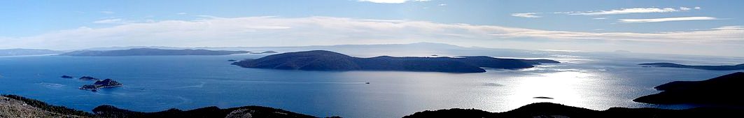
The Adriatic Sea is a body of water separating the Italian Peninsula from the Balkan peninsula and the Apennine Mountains from the Dinaric Alps and adjacent ranges. The Adriatic is the northernmost arm of the Mediterranean Sea, extending from the Strait of Otranto (where it connects to the Ionian Sea) to the northwest and the Po Valley. The countries with coasts on the Adriatic are Italy, Croatia, Albania, Montenegro, Bosnia-Herzegovina, and Slovenia. The Adriatic contains over 1,300 islands, mostly located along its eastern, Croatian, coast. It is divided into three basins, the northern being the shallowest and the southern being the deepest, with a maximum depth of 1,233 metres (4,045 ft). The Otranto Sill, an underwater ridge, is located at the border between the Adriatic and Ionian Seas. The prevailing currents flow counterclockwise from the Strait of Otranto, along the eastern coast and back to the strait along the western
(Italian) coast. Tidal movements in the Adriatic are slight, although larger amplitudes are known to occur occasionally. The Adriatic's salinity is lower than the Mediterranean's because the Adriatic collects a third of the fresh water flowing into the Mediterranean, acting as a dilution basin. The surface water temperatures generally range from 24 °C (75 °F) in summer to 12 °C (54 °F) in winter, significantly moderating the Adriatic Basin's climate.
The Adriatic Sea sits on the Apulian or Adriatic Microplate, which separated from the African Plate in the Mesozoic era. The plate's movement contributed to the formation of the surrounding mountain chains and Apennine tectonic uplift after its collision with the Eurasian plate. In the Late Oligocene, the Apennine Peninsula first formed, separating the Adriatic Basin from the rest of the Mediterranean. All types of sediment are found in the Adriatic, with the bulk of the material transported by the Po and other rivers on the western coast. The western coast is alluvial or terraced, while the eastern coast is highly indented with pronounced karstification. There are dozens of marine protected areas in the Adriatic, designed to protect the sea's karst habitats and biodiversity. The sea is abundant in flora and
fauna. More than 7,000 species are identified as native to the Adriatic, many of them endemic, rare and threatened ones.
The Adriatic's shores are populated by more than 3.5 million people; the largest cities are Bari, Venice, Trieste and Split. The earliest settlements on the Adriatic shores were Etruscan, Illyrian, and Greek. By the 2nd century BC, the shores were under the Roman Republic's control. In the Middle Ages, the Adriatic shores and the sea itself were controlled, to a varying extent, by a series of
states, most notably the Byzantine Empire, the Republic of Venice, the Habsburg Monarchy and the Ottoman Empire. The Napoleonic Wars resulted in the First
French Empire gaining coastal control and the British effort to counter the French in the area, ultimately securing most of the eastern Adriatic shore and the Po Valley for Austria. Following Italian unification, the Kingdom of Italy started an eastward expansion that lasted until the 20th century. Following
World War I and the collapse of Austria-Hungary and the Ottoman Empire, the eastern coast's control passed to Yugoslavia and Albania. The former disintegrated in the 1990s, resulting in four new states on the Adriatic coast. Italy and Yugoslavia agreed on their maritime boundaries by 1975 and this boundary is recognised by Yugoslavia's successor states, but the maritime boundaries between Slovenian, Croatian, Bosnian–Herzegovinian and Montenegrin waters are disputed.
Italy and Albania agreed on their maritime boundary in 1992.
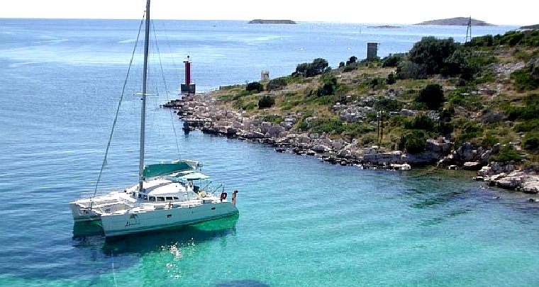
Fisheries and tourism are significant sources of income all along the Adriatic coast. Adriatic Croatia's tourism industry has grown faster economically than the rest of the Adriatic Basin's. Maritime transport is also a significant branch of the area's
economy. There are 19 seaports in the Adriatic that each handle more than a million tonnes of cargo per year. The largest Adriatic seaport by annual cargo turnover is the Port of Trieste, while the Port of Split is the largest Adriatic seaport by passengers served per year.
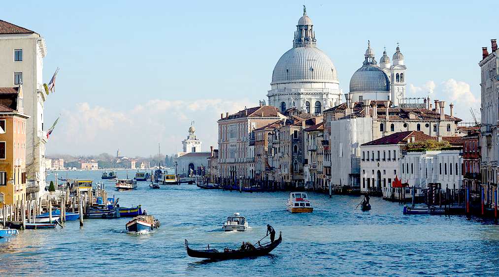
Venice is the capital of the Veneto region in Italy. In 2009, there were 270,098 people residing in Venice's comune (the population estimate of 272,000 inhabitants includes the population of the whole Comune of
Venezia; around 60,000 in the historic city of Venice (Centro storico); 176,000 in Terraferma (the Mainland), mostly in the large frazioni (roughly equivalent to "parishes" or "wards" in other countries) of Mestre and
Marghera; 31,000 live on other islands in the lagoon). Together with Padua and
Treviso, the city is included in the Padua-Treviso-Venice Metropolitan Area
(PATREVE), with a total population of 1,600,000. PATREVE is only a statistical metropolitan area without any degree of autonomy.
The name is derived from the ancient Veneti people who inhabited the region by the 10th century BC. The city historically was the capital of the Republic of Venice. Venice has been known as the "La
Dominante", "Serenissima", "Queen of the Adriatic", "City of Water", "City of Masks", "City of Bridges", "The Floating City", and "City of Canals". Luigi Barzini described it in The New York Times as "undoubtedly the most beautiful city built by man". Venice has also been described by the Times Online as being one of Europe's most romantic cities.
The Republic of Venice was a major maritime power during the Middle Ages and Renaissance, and a staging area for the Crusades and the Battle of
Lepanto, as well as a very important center of commerce (especially silk, grain, and spice) and art in the 13th century up to the end of the 17th century. This made Venice a wealthy city throughout most of its history. It is also known for its several important artistic movements, especially the Renaissance period. Venice has played an important role in the history of symphonic and operatic music, and it is the birthplace of Antonio
Vivaldi.
The buildings of Venice are constructed on closely spaced wooden piles. Most of these piles are still intact after centuries of submersion. The foundations rest on plates of Istrian limestone placed on top of the
piles, and buildings of brick or stone sit above these footings. The piles penetrate a softer layer of sand and mud until they reach a much harder layer of compressed clay.
Submerged by water, in oxygen-poor conditions, wood does not decay as rapidly as on the surface.
Most of these piles were made from trunks of alder trees, a wood noted for its water resistance.
POLLUTION
The Adriatic Sea ecosystem is threatened by excessive input of nutrients through drainage from agricultural land and wastewater flowing from cities; this includes both along its coast and from rivers draining into the
sea, especially from the Po River. Venice is often cited as an example of polluted coastal waters where shipping, transportation, farming, manufacturing and wastewater disposal contribute to polluting the sea. A further risk is presented by ballast water discharge by ships, especially tankers. Still, since most of the cargo handled by the Adriatic ports, and virtually all liquid
(tanker) cargo handled by the ports, is coming
to - not coming from - the Adriatic Basin, the risk from ballast water (from tankers expelling ballast water then loading in the Adriatic) remains minimal. However, proposed export oil pipelines were objected to specifically because of this issue.
Oil spills are a major concern in terms of potential environmental impact and damage to tourism and fisheries. It is estimated that if a major oil spill happened, a million people would lose their livelihoods in Croatia alone. An additional risk is presented by oil refineries in the Po River basin where oil spills have occurred before, in addition to accidents occurring in the Adriatic already, so far with no significant environmental consequences. Since 2006, Italy has been considering the construction of an offshore and an onshore LNG terminal in the Gulf of Trieste, as well as a pipeline, in the immediate vicinity of the Slovenian–Italian border. The Slovenian government and municipalities, the municipal council of Trieste, and non-governmental organisations have voiced concern over their environmental hazards, effect on transport and effect on tourism.
Another source of pollution of the Adriatic is solid waste. Drifting waste
- occasionally relatively large quantities of material, especially waste
plastic - is transported northwest by the sirocco. Air pollution in the Adriatic Basin is associated with the large industrial centres in the Po River valley and the large industrial cities along the coast.
Italy and Yugoslavia established a joint commission to protect the Adriatic Sea from pollution in 1977; the organization later changed with Slovenia,
Croatia and Montenegro replacing Yugoslavia. Future pollution hazards are addressed and pollution hotspots are assessed not only by nations in the basin but also through regional projects with World Bank support. 27 such hotspots have been determined as of 2011, 6 warranting an urgent response.
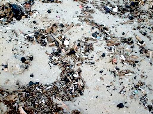
A
beach on an Adriatic coast covered in plastic and other waste
FISHING
The Adriatic Sea fishery's production is distributed among countries in the basin. In 2000, the
nominal - on a live weight basis - total landings of all Adriatic fisheries reached 110,000 tonnes (108,000 long tons). Overfishing is a recognised
problem. 450 species of fish live in the Adriatic Sea, including 120 species threatened by excessive commercial
fishing. This is a problem exacerbated by pollution and global warming. Overexploited species include common dentex, red scorpionfish, monkfish, John Dory, blue
shark, spiny dogfish, mullet, red mullet, Norway lobster, as well as European hake, and sardines.
Turtles and common bottlenose
dolphins are also being killed by fishing nets. The depleted fish stock, and Croatia's Ecological and Fisheries Protection Zone (ZERP) contributed to accusations of overfishing exchanged between Italian and Croatian fishermen. ZERP was introduced in 2003, but its application to EU member states was suspended in 2004. The depleted stocks of fish are being addressed through new proposed EU fisheries policy had has been scheduled to take effect in 2013, when Croatia acceded to the
EU, and restore the stocks to sustainable levels by 2015.
The largest volume of fish harvesting was in Italy, where the total production volume in 2007 stood at 465,637 tonnes (458,283 long tons). In 2003, 28.8% of Italian fisheries production volume was generated in the Northern and central Adriatic, and 24.5% in Apulia (from the Southern Adriatic and Ionian Sea). Italian fisheries, including those operating outside the Adriatic, employed 60,700 in the primary sector, including aquaculture (which comprises 40% of the total fisheries production). The total fisheries output's gross value in 2002 was $1.9 billion.
In 2007, Croatia's production in live weight reached 53,083 tonnes (52,245 long tons). In 2006, the total Croatian fisheries production volume was 37,800 tonnes (37,200 long tons) of catch and 14,200 tonnes (14,000 long tons) from marine aquaculture. Croatian fisheries employed approximately 20,000. The 2006 marine capture catch in Croatian waters consisted of sardines (44.8%), anchovies (31.3%), tunas (2.7%), other pelagic fish (4.8%), hake (2.4%), mullet (2.1%), other demersal fish (8.3%), crustaceans (largely lobster and Nephrops norvegicus) (0.8%), shellfish (largely oysters and mussels) (0.3%), cuttlefish (0.6%), squids (0.2%) and octopuses and other cephalopods (1.6%). Croatian marine aquaculture production consisted of
tuna (47.2%), oysters and mussels (28.2% combined) and bass and bream (24.6% combined).
In 2007, Albanian fisheries production amounted to 7,505 tonnes (7,386 long tons), including aquaculture production, which reached 1,970 tonnes (1,940 long tons) in 2006. At the same time, Slovenian fisheries produced a total of 2,500 tonnes (2,460 long tons) with 55% of the production volume originating in aquaculture, representing the highest ratio in the Adriatic. Finally, the Montenegrin fisheries production stood at 911 tonnes (897 long tons) in 2006, with only 11 tonnes coming from aquaculture. In 2007, the fisheries production in Bosnia–Herzegovina reached volume of 9,625 tonnes (9,473 long tons) and 2,463 tonnes (2,424 long tons) in Slovenia.
TOURISM
The countries bordering the Adriatic Sea are significant tourist destinations. The largest number of tourist overnight stays and the most numerous tourist accommodation facilities are recorded in Italy, especially in the Veneto region (around Venice). Veneto is followed by the Emilia-Romagna region and by the Adriatic Croatian counties. The Croatian tourist facilities are further augmented by 21,000 nautical ports and moorings; nautical tourists are attracted to various types of marine protected areas.
All countries along the Adriatic coast, except Albania and Bosnia–Herzegovina, take part in the Blue Flag beach certification programme (of the Foundation for Environmental Education), for beaches and marinas meeting strict quality standards including environmental protection,
water quality, safety and services criteria. As of January 2012, the Blue Flag has been awarded to 103 Italian Adriatic beaches and 29 marinas, 116 Croatian beaches and 19 marinas, 7 Slovenian beaches and 2 marinas, and 16 Montenegrin beaches. Adriatic tourism is a significant source of income for these countries, especially in Croatia and Montenegro where the tourism income generated along the Adriatic coast represents the bulk of such income. The direct contribution of travel and tourism to Croatia's GDP stood at 5.1% in 2011, with the total industry contribution estimated at 12.8% of the national GDP. For Montenegro, the direct contribution of tourism to the national GDP is 8.1%, with the total contribution to the economy at 17.2% of Montenegrin GDP. Tourism in Adriatic Croatia has recently exhibited greater growth than in the other regions around the Adriatic.
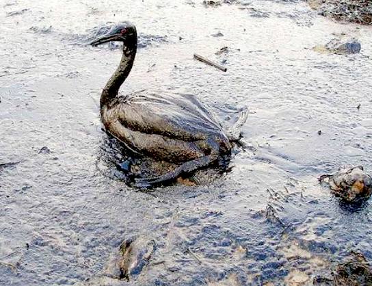
Seabirds
and fish suffer from oil spills in the Adriatic Sea. Tankers and big vessels are two causes of
this pollution in Adriatic seas, with industry also responsible for
dumping chemicals in the mix. Last year there was a great problem in the river Po because industry released
poisons in it.
OIL AND GAS
Natural gas is produced through several projects, including a joint venture of the Eni and INA companies that operates two
platforms - one is in Croatian waters and draws gas from six wells, and the other (which started operating in 2010) is located in Italian waters. The Adriatic gas fields were discovered in the 1970s, but their development commenced in 1996. In 2008, INA produced 14.58 million BOE per day of gas. About 100 offshore platforms are located in the Emilia-Romagna
region, along with 17 in the Northern Adriatic. Eni estimated its concessions in the Adriatic Sea to hold at least 40,000,000,000 cubic metres (1.4×10¹² cu ft) of natural gas, adding that they may even reach 100,000,000,000 cubic metres (3.5×10¹² cu ft). INA estimates, however, are 50% lower than those supplied by Eni. Oil was discovered in the Northern Adriatic at a depth of approximately 5,400 metres (17,700 ft); the discovery was assessed as not viable because of its location, depth and quality. These gas and oil reserves are part of the Po basin Province of Northern Italy and the Northern
Mediterranean Sea.
In the 2000s, investigation works aimed at discovering gas and oil reserves in the Middle and Southern Adriatic basins intensified, and by the decade's end,
oil and natural gas reserves were discovered southeast of the Bari, Brindisi
- Rovesti and Giove oil discoveries. Surveys indicate reserves of 3 billion barrels of
oil in place and 5.7×10¹⁰ cubic metres (2,000,000,000,000 cu ft) of gas in place. The discovery was followed by further surveys off the Croatian coast. In January 2012, INA commenced prospecting for oil off Dubrovnik, marking the resumption of oil exploration along the eastern Adriatic coast after surveys commenced in the late 1980s around the island of Brač were cancelled because of Yugoslavia's breakup and war in Croatia. Montenegro is also expected to look for oil off its coast. As of January 2012, only 200 exploration wells had been sunk off the Croatian coast, with all but 30 in the Northern Adriatic basin.
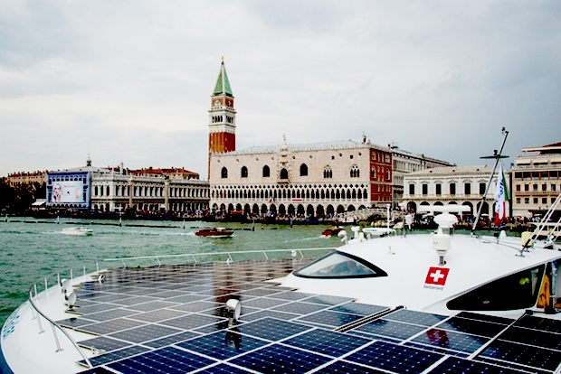
The
PlanetSolar in Venice 9th October 2014, Grand Canal
FLORA AND FAUNA
The unique nature of the Adriatic gives rise to an abundance of endemic flora and fauna. The Croatian National Biodiversity Strategy Action Plan identified more than 7,000 animal and plant species in the Adriatic Sea. The Central Adriatic is especially abundant in endemic plant species, with 535 identified species of green, brown and red algae. Four out of five Mediterranean seagrass species are found in the Adriatic Sea. The most common species are Cymodocea nodosa and Zostera noltii, while Zostera marina and Posidonia oceanica are comparably rare.
A number of rare and threatened species are also found along the Adriatic's eastern coast; it is relatively clearer and less polluted than the western Adriatic coast—in part because the sea currents flow through the Adriatic in a counterclockwise direction, thus bringing clearer waters up the eastern coast and returning increasingly polluted water down the western coast. This circulation has significantly contributed to the biodiversity of the countries along the eastern Adriatic coast; the common bottlenose
dolphin is frequent in the eastern coast's waters only, and the Croatian coast provides refuge for the critically endangered monk seal and sea turtles.
The Northern Adriatic in particular is rich in endemic fish fauna. Around thirty species of fish are found in only one or two countries bordering the Adriatic Sea. These are particularly due to or dependent upon the karst morphology of the coastal or submarine topography; this includes inhabiting subterranean habitats, karst rivers, and areas around freshwater springs. There are 45 known subspecies endemic to the Adriatic's coasts and islands. In the Adriatic, there are at least 410 species and subspecies of fish, representing approximately 70% of Mediterranean taxa, with at least 7 species endemic to the Adriatic. Sixty-four known species are threatened with extinction, largely because of
over-fishing. Only a small fraction of the fish found in the Adriatic are attributed to recent processes such as Lessepsian migration, and escape from mariculture.
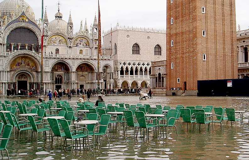
During the 20th century, when many artesian wells were sunk into the periphery of the lagoon to draw water for local industry, Venice began to subside. It was realised that extraction of water from the aquifer was the cause. The sinking has slowed markedly since artesian wells were banned in the 1960s. However, the city is still threatened by more frequent low-level floods (called Acqua alta, "high water") that creep to a height of several centimetres over its quays, regularly following certain tides. In many old houses, the former staircases used to unload goods are now flooded, rendering the former ground floor uninhabitable.
COASTAL MANAGEMENT
Venice, which was originally built on islands off the coast, is most at risk due to subsidence, but the threat is present in the Po delta as well. The causes are a decrease in sedimentation rate due to loss of sediment behind dams, the deliberate excavation of sand for industrial purposes, agricultural use of water, and removal of ground water.
The sinking of Venice slowed after artesian wells were banned in the 1960s, but the city remains threatened by the acqua alta floods. Recent studies have suggested that the city is no longer sinking, but a state of alert remains in place. In May 2003, then-Prime Minister Silvio Berlusconi inaugurated the MOSE project (Italian: Modulo Sperimentale Elettromeccanico), an experimental model for evaluating the performance of inflatable gates. The project proposes laying a series of 79 inflatable pontoons across the sea bed at the three entrances to the Venetian Lagoon. When tides are predicted to rise above 110 centimetres (43 in), the pontoons will be filled with air and block the incoming water from the Adriatic Sea. This engineering work is due to be completed by 2014.
CLIMATE
As in most Mediterranean Basin areas, the Adriatic Sea and its surrounding landmass enjoy the Mediterranean climate, a type of subtropical climate. Since the Adriatic Sea is located in the mid-latitudes, it is characterized by a seasonally variable
climate; it is also characterized by warm to hot, dry summers and mild to cool, wet winters. The air temperature fluctuates by about 20 °C (36 °F) during a season. According to the Köppen climate classification, the southern and central Adriatic are classified as hot-summer Mediterranean climate (Csa) and the northern Adriatic as humid subtropical climate (Cfa) areas. The predominant winter winds are the bora and sirocco (called jugo along the eastern coast). The bora is significantly conditioned by wind gaps in the Dinaric
Alps bringing cold and dry continental air; it reaches peak speeds in the areas of Trieste, Senj, and Split, with gusts of up to 180 kilometres per hour (97 kn; 110 mph). The sirocco brings humid and warm air, often carrying
Saharan sand causing rain dust.
Venice is one of the most important
tourist destinations in the world for its celebrated art and architecture. The city has an average of 50,000 tourists a day (2007 estimate). In 2006, it was the world's 28th most internationally visited city, with 2.927 million international arrivals that year. It is regarded as one of the world's most beautiful cities.
Some sources state that the city is no longer sinking, but this is not yet certain; therefore, a state of alert has not been revoked.
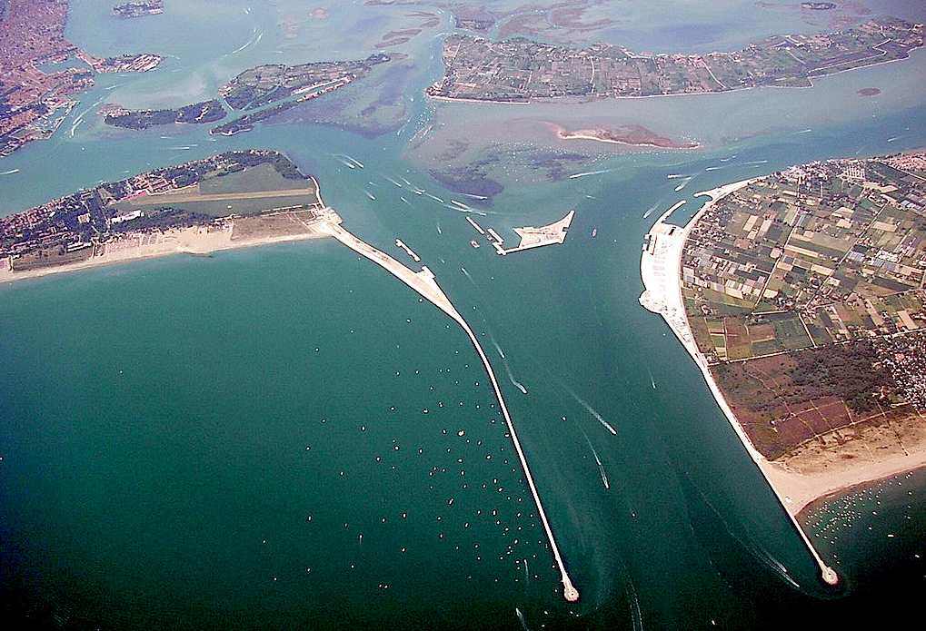
MOSE
MOSE (MOdulo Sperimentale Elettromeccanico, Experimental Electromechanical Module) is a project intended to protect the city of Venice, Italy, and the Venetian Lagoon from flooding. The project is an integrated system consisting of rows of mobile gates installed at the Lido, Malamocco and Chioggia inlets that are able to temporarily isolate the Venetian Lagoon from the Adriatic Sea during high tides. Together with other measures such as coastal reinforcement, the raising of quaysides, and the paving and improvement of the lagoon, MOSE is designed to protect Venice and the lagoon from tides of up to 3 metres (9.8 ft).
The Consorzio Venezia Nuova is responsible for the work on behalf of the Ministry of Infrastructure and Transport – Venice Water Authority. Construction began simultaneously in 2003 at all three lagoon inlets, and as of June 2013, 80% of the project has been completed.
...
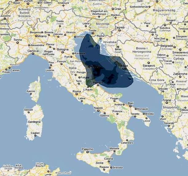
A
map showing the extent of oil pollution in the Adriatic
ACIDIFICATION
- ADRIATIC
- ARCTIC
- ATLANTIC - BALTIC
- BAY BENGAL - BERING
- BLACK - CARIBBEAN - CORAL - EAST
CHINA
ENGLISH CH
-
GOC - GULF
GUINEA - GULF
MEXICO
- HORMUZ - INDIAN
-
IOC
-
IRC - MEDITERRANEAN -
NORTH SEA - PACIFIC
- PERSIAN GULF
RED
SEA - SEA
JAPAN - STH
CHINA - PLASTIC
- PLANKTON - PLASTIC
OCEANS - SEA
LEVEL RISE - TAIWAN - UNCLOS
- UNEP
WOC
- WWF
AMAZON
- BURIGANGA - CITARUM - CONGO - CUYAHOGA
-
GANGES - IRTYSH
- JORDAN - LENA -
MANTANZA-RIACHUELO
MARILAO
- MEKONG - MISSISSIPPI - NIGER - NILE - PARANA - PASIG - SARNO - THAMES
- YANGTZE - YAMUNA - YELLOW
LINKS
& REFERENCE
Abroad
In The Yard 9000-year-old-fishing-traps-found-on-bottom-of-baltic-sea Baltic
Sea 2020
Wikipedia
Baltic_Sea
Britannica
Baltic-Sea Baltic
Sea Save
Our Baltic Sea Youtube
Watch IOL
Ferry-explodes-on-the-baltic-sea News
Wave branding-baltic-sea-region-style Helcom
The
Baltic Anomaly
Vilnius
Macerata Adriatic and Baltic seas pollution Wikipedia
MOSE_Project
Wikipedia Adriatic_Sea http://www.charterworld.com/news/strategy-adriatic-ionian-seas-presented-european-commission http://europa.eu/rapid/press-release_MEMO-14-429_en.htm https://ec.europa.eu/maritimeaffairs/policy/sea_basins/adriatic_ionian_en http://www.blue-world.org/en/special-projects/AdriaticPlus/ http://isig.it/en/medtrends/ http://en.wikipedia.org/wiki/MOSE_Project
http://en.wikipedia.org/wiki/Adriatic_Sea http://vilnius-macerata.wikispaces.com/Adriatic+and+Baltic+seas+pollution
http://www.abroadintheyard.com/9000-year-old-fishing-traps-found-on-bottom-of-baltic-sea/
http://www.balticsea2020.org
http://en.wikipedia.org/wiki/Baltic_Sea
http://www.britannica.com/EBchecked/topic/50963/Baltic-Sea
http://balticsea.com/ http://www.saveourbalticsea.com/ http://www.youtube.com/watch?v=20y2NvIEB7E#t=139 http://www.iol.co.za/news/world/ferry-explodes-on-the-baltic-sea-1.685008#.VCx651cXOSo
http://newswave.eu/place-branding-baltic-sea-region-style/
http://thebalticanomaly.se/
http://helcom.fi/
CLEAN
UP YOUR OCEAN - Based on the Bluefish ZCC concept, that above
feasibility design is a proposed trimaran test rig, using off-the-shelf
components to get a feel for the concept. This is in no way a complete
solution, but then we have to start somewhere. What we learn from these
small scale experiments, could eventually help us to formulate a dual
purpose, ocean capable cruiser, to clean up the Baltic Sea and local
harbours, with a view to cleansing the marine environment and improving
the quality of beaches and locally caught fish, etc. Full size, this
autonomous vessel could harvest up to 50 tons of plastic,
before it has to offload. There is an existing market for recycled
plastic. That's good, because building the world's largest robot
vacuum cleaner is not going to be easy. We need all the support
we can get.
|