|
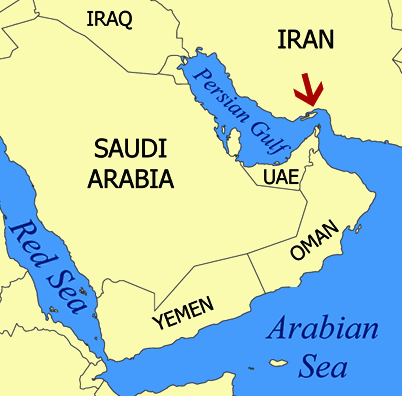
Location
map of the Persian Gulf between Saudi Arabia, the UAE and Iran
ISIS
WAR PERSIAN GULF CASUALTY
The U.S.-led attack on the Islamic State group claimed its first American life Thursday when a search and rescue operation was called off for a U.S. Marine who went missing in the Persian Gulf after his aircraft suffered technical problems, the U.S. Navy said. The statement was reported by BNO News as well as Central Command.
The Marine airman, whose identity was not immediately released, was among four people aboard a U.S. Marine Corps MV-22B Osprey aircraft that took off from the USS Makin Island on Wednesday afternoon (local time) before suffering a loss of power. Two of the crew members bailed out of the aircraft when it appeared it was about to crash into the ocean.
The pilot of the Osprey was eventually able to regain control of the aircraft and managed to land safely aboard the USS Makin Island, and then a search and rescue was launched. One of the two who exited the aircraft was pulled out of the water and taken back to the amphibious assault ship, where he was reported in a stable condition.
“U.S. Navy, Marine Corps and Coast Guard personnel conducted an extensive search of the area using all available assets, which continued throughout the night and the next day,” U.S. Naval Forces Central Command said in a statement. It said the search in the North Persian Gulf was called off at 1500 GMT (11 a.m. EDT) Thursday after efforts to locate the missing man were unsuccessful.
The U.S. Navy said the Osprey aircraft was participating in flight operations in support of a U.S.-led air campaign against the Islamic State group in Iraq and Syria. Wednesday’s casualty makes him the first coalition service member to die during operations in support of the military campaign against ISIS.
THE
PERSIAN GULF
The Persian Gulf is located in Western Asia between Iran to the northeast and the Arabian Peninsula to the southwest. The Persian Gulf is an extension of the Indian Ocean (Gulf of Oman) through the Strait of Hormuz. The Shatt al-Arab river delta forms the northwest shoreline.
The Gulf was a battlefield of the 1980–1988 Iran-Iraq War, in which each side attacked the other's oil tankers. It is the namesake of the 1991 Gulf War, the largely air- and land-based conflict that followed Iraq's invasion of Kuwait.
The Persian Gulf has many fishing grounds, extensive coral reefs, and abundant pearl oysters, but its ecology has been damaged by industrialization and oil spills.
The body of water is historically and internationally known as the "Persian Gulf". Some Arab governments refer to it as the "Arabian Gulf" or "The
Gulf", but neither term is recognized internationally. The name "Gulf of Iran (Persian Gulf)" is used by the International Hydrographic Organization.
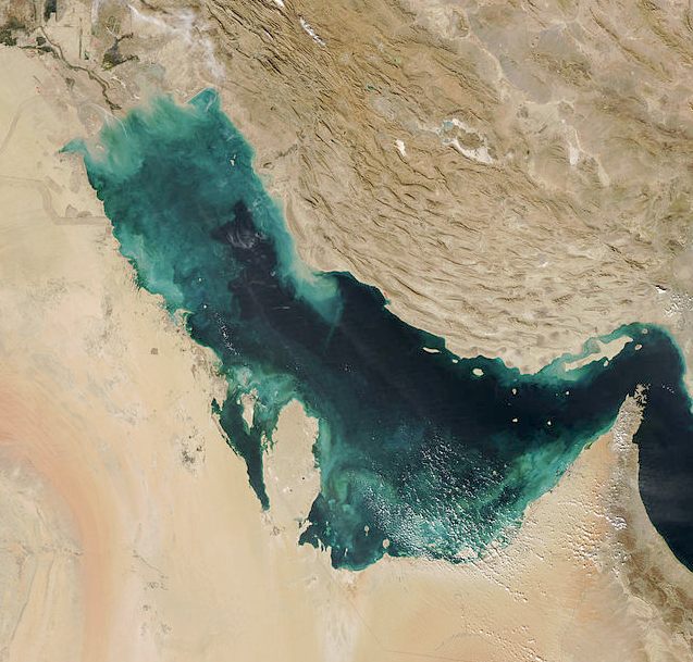
Satellite
picture of the Persian Gulf
GEOGRAPHY
This inland sea of some 251,000 square kilometres (96,912 sq mi) is connected to the Gulf of Oman in the east by the Strait of Hormuz; and its western end is marked by the major river delta of the Shatt al-Arab, which carries the waters of the Euphrates and the Tigris. Its length is 989 kilometres (615 miles), with Iran covering most of the northern coast and Saudi Arabia most of the southern coast. The Persian Gulf is about 56 km (35 mi) wide at its narrowest, in the Strait of Hormuz. The waters are overall very shallow, with a maximum depth of 90 metres (295 feet) and an average depth of 50 metres (164 feet).
Countries with a coastline on the Persian Gulf are (clockwise, from the north): Iran, Oman (exclave of Musandam), United Arab Emirates, Saudi Arabia, Qatar on a peninsula off the Saudi coast, Bahrain on an island, Kuwait and Iraq in the northwest. Various small islands lie within the Persian Gulf, some of which are the subject of territorial disputes between the states of the region.
In 2012 the UN increased banking and energy sanctions, and Iran has responded with threats to mine the Strait of Hormuz and choke off a fifth of the world's oil supply. In reply the US Navy announced that it will ensure that the Strait remains open by any means necessary—including blowing up Iran's mines with smaller, American drone mines like the
SeaFox.
Built by Altas Elektrik, a conglomeration of ThyssenKrupp (the coffee maker guys) and EADS (a major aerospace
contractror), the SeaFox is a semi-autonomous, single-serving UAV mine hunter. It measures roughly four feet long and weighs just 88 pounds, including the large shaped charge attached to its nose, with a range of 3200 feet and top speed of six knots.
After an Avenger sweeps the Strait for potential subsurface mines, the ship's crew can simply toss a SeaFox overboard. The submersible's integrated homing sonar will autonomously guide the UAV back to the underwater objects the Avenger found for further investigation. When the SeaFox approaches one of these objects, it's on-board CCTV feeds live images back to the human controller via a fiber optic line. If the object turns out to be a mine, the SeaFox (at its operator's behest) will ram the mine, detonate its explosive charge and destroy both the mine and the $100,000 submersible itself.
"In the Cold War, minesweeping warfare was a large part of what the Navy did, but we have lost a lot of our minesweeping capability," said Harmer, a senior analyst at the Institute for the Study of War, told
KTLA. "The SeaFox is a relatively simple, off-the-shelf system that we can put off our minesweepers but also any surface ship."
The US Navy reportedly purchased a large number of SeaFoxes between February and May of this year at the urging of Marine Gen. James
Mattis, the top U.S. commander in the Middle East and has already deployed them to the Persian Gulf region, along with four MH-53 Sea Dragon helicopters—which can deploy the SeaFox as well—and four additional Avenger-class mine sweepers.
Pentagon officials estimate if Iran was foolish enough to try and close the Strait of Hormuz using its estimated arsenal of 2,000 mines, the US Navy and allied nations would be able to clear it in five to ten days. That's just long enough to likely cause massive spikes in worldwide oil prices, disrupt global shipping traffic, and would be tantamount to a declaration of war. "If they wanted to close the Strait of
Hormuz, they could do it, but they would only be able to do it one time," Christopher Harmer, a retired Navy commander who served as director of future operations at U.S. 5th Fleet headquarters in Bahrain, told
KTLA.
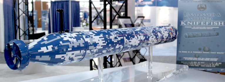
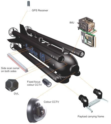
The Knifefish is an unmanned underwater vehicle
(UUV) under development by General Dynamics Advanced Information Systems and Bluefin Robotics for the United States Navy. It is a propeller-driven minesweeping robot designed to replace the Navy's trained dolphins and sea lions after the retirement of the 50-year-old Marine Mammal Program in 2017. The Knifefish was first unveiled at a Navy exposition in April 2012, and is intended to operate in concert with the Navy's littoral combat ships
(LCS) as part of a specialised counter-mine system. The Navy plans to begin sea trials of the Knifefish in 2015, and to enter it into active service in 2017.
By December 2012, the Navy had ordered eight Knifefish units, at a total cost of US$20 million. They are scheduled to begin sea trials in 2015, and to enter into active service in 2017, coincident with the end of the Marine Mammal Program. In April 2013, General Dynamics completed its critical design review of the
Knifefish, and began developing software and hardware for the operational version of the robot.
DESIGN - The robot is a derivative of the Bluefin-21, a civilian UUV designed by the Quincy, Massachusetts-based company Bluefin Robotics. In 2014, the Bluefin-21 gained widespread recognition after it was deployed by international rescue organisations to search the seafloor of the Indian Ocean for the wreckage of Malaysia Airlines Flight 370.
The Knifefish is a torpedo-shaped robot 19 feet (5.8 m) in length and 21 inches (0.53 m) in diameter, with an operational weight of 1,700 pounds (770 kg). It is powered by a lithium-ion battery, which allows it to operate for up to 16 hours on pre-programmed search missions. It uses onboard synthetic aperture sonar to detect floating or buried naval mines, and can identify a wide variety of mines and mine-like objects using an onboard database and analytical computer. Detected mines will then be marked and their locations recorded in the Knifefish's database; the robot will later upload the data to its parent
LCS, which will destroy the mines. The Knifefish may be modified to transmit its data in real-time, if the Navy considers such a capability necessary after the robot's sea trials. Each LCS will be capable of operating two Knifefish
UUVs, which will scan the seabed near the ship and reduce the risk of mine damage to the LCS
itself.
COLD
WAR NAVAL MINE CLEARANCE
According
to 2013 estimates, roughly 17 million barrels of oil
pass through the Straight of Hormuz between Oman and Iran each day. When
Iran threatened to close it down in 2012, Pentagon officials determined
that the estimated arsenal of 2,000 undersea mines
could be cleared in about a week. In this case, a German-made drone known
as the Seafox would be tasked for the job. The 4-foot (1.2m), 100-pound
(45kg) Seafox is semiautonomous but relies upon a fiber optic tether for
communications. It “diffuses” mines after identifying them by
triggering an explosive self-destruct sequence that effectively ends its
own tour of duty. At $100,000 a pop, other
solutions to keep the routes of commerce safe and open are needed.
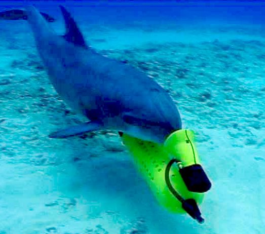
Previously,
the US Navy used trained dolphins
to locate mines
The Navy has now set its sights on the Knifefish, named for the freshwater fish that images objects using electric fields. At 19 feet (5.8m) and 1700 pounds (770kg), the
torpedo-shaped drone is much larger than the Seafox and will greatly extend its capabilities. It is powered by lithium-ion batteries and can remain active for up to 16 hours, giving it a much longer range. It also uses a low-frequency synthetic aperture sonar that can penetrate beneath a soft sea floor. The Knifefish will be able to tell actual mines from other submerged debris with better accuracy. Mines will be able to be fingerprinted in real time by using resonance patterns obtained during imaging and comparing them to known signatures. Eight units will be jointly built by General Dynamics and
Bluefin
Robotics, at a total cost of $20 million. Naval divers will still carry out many mine clearing operations themselves, but drones will reduce dive frequency and associated risk.
The deployment of Knifefish, and their larger intended successors, raises a few strategical issues and hints to the need for greater cooperative efforts between nations. Not yet able to destroy mines directly, the Knifefish will initially map and image mines, and send the data elsewhere. Tankers or cruise ships that can afford extra assurance, or insurance as the case may be, might use a Knifefish-like shepherd when navigating critical waterways. At some point however, with many vessels sweeping and reporting the same threat concerns, someone has to take responsibility to go and eliminate them. The question of whose job this becomes is reflective of a similar drama soon to be played out in space with the looming problem of orbital debris.
Other maritime roles of the Knifefish could include routine patrol of pipelines or offshore oil and mineral fields. Recent proposed budget cuts to the Navy and Pentagon may have the effect of shifting responsibility to corporate ventures for protecting less strategic installations such as wind parks or private telecommunications links, however. While undersea drones lack the navigational flexibility and sonar virtuosity of their mammalian brethren, designers are quickly learning to incorporate their tricks. With enough drones mapping the oceans, the other final frontier is destined to become much more familiar, and a little safer.
ACIDIFICATION
- ADRIATIC - ARCTIC
- ATLANTIC - BALTIC
- BERING - CARIBBEAN
- CORAL - EAST
CHINA
ENGLISH
CH - GULF MEXICO -
HORMUZ - INDIAN
- MEDITERRANEAN - NORTH
SEA - PACIFIC - PERSIAN
GULF -
RED
SEA
SEA JAPAN
- STH
CHINA - PLASTIC
- PLANKTON - PLASTIC
OCEANS - SEA
LEVEL RISE - TAIWAN
LINKS
& REFERENCE
IB
Times isis-wars-first-us-casualty-marine-lost-persian-gulf Wikipedia
Persian_Gulf
Wikipedia
Strait_of_Hormuz Gizmodo
the strait of hormuz will keep flowing thanks to the sea fox Royal
Navy MOD patrol and mine hunters counter measure vessels Wikipedia
Knifefish robot http://www.ibtimes.com/isis-wars-first-us-casualty-marine-lost-persian-gulf-1698879 http://en.wikipedia.org/wiki/Persian_Gulf
http://en.wikipedia.org/wiki/Strait_of_Hormuz
http://gizmodo.com/5925833/the-strait-of-hormuz-will-keep-flowing-thanks-to-the-sea-fox http://www.royalnavy.mod.uk/the-equipment/ships/patrol-and-mine-hunters/mine-counter-measure-vessels http://en.wikipedia.org/wiki/Knifefish_%28robot%29
PATENT
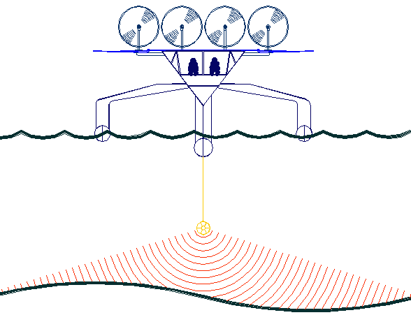
PENDING - A non-polluting vessel such as Bluefish ZCC above is a conceptual prototype
presently being developed for licensing to shipbuilders. The Bluefish is a robotic
ocean workhorse that is based on a stable
SWASH
hull that uses no diesel fuel to monitor the oceans autonomously (COLREGS
compliant) at relatively high
speed 24/7 and 365 days a year - only possible with the revolutionary energy harvesting
system that you can read about using the above links. The
hullform is ideal for automatic release and recovery of ROVs
or towed arrays, alternating between drone and fully autonomous modes.
This vessel
pays for itself in fuel saved every ten
years and could be scaled up to oil tanker size.
We invite you to develop your own versions of such craft based on this
technology under license.
Adapted versions of this ZCC would make an ideal fleet to clean up large
areas of oceans, such as the plastic gyre garbage patches that the UN
are concerned about.
|