|
US
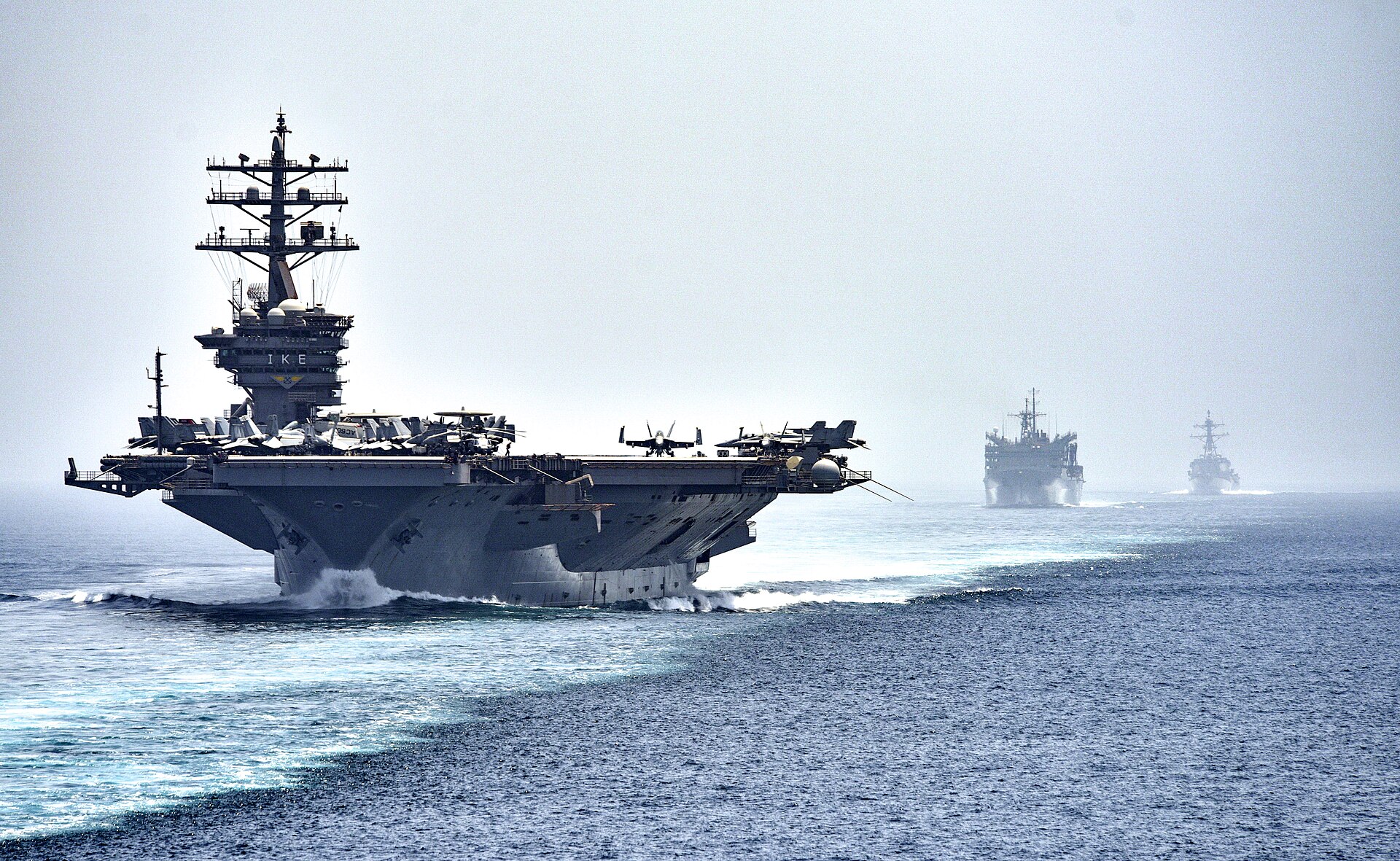
NAVY - Aircraft carrier in the Strait of Hormuz, another important seaway
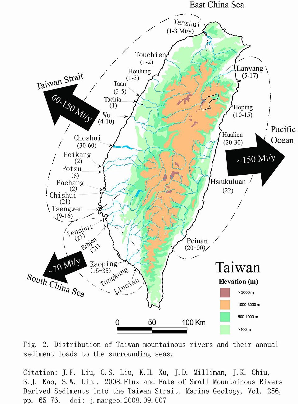
The Taiwan Strait is a 180-kilometer-wide (110 mi; 97 nmi) strait separating the island of Taiwan and the Asian continent; Fujian Province. The strait connects the South
China Sea to the south, and the East China Sea to the north. The narrowest part is 126 km (78 mi; 68 nmi) wide.
Former names of the Taiwan Strait include the Formosa Strait or Strait of Formosa, from a dated name for Taiwan; the Strait of Fokien or Fujian, from the Chinese province forming the strait's western shore; and the Black Ditch, a calque of the strait's name in Hokkien and Hakka.
An international agreement does not define the Taiwan Strait but places its waters within the South China Sea, whose northern limit runs from Cape Fugui (the northernmost point on Taiwan Island; Fukikaku) to Niushan Island to the southernmost point of Pingtan Island and thence westward along the parallel 25° 24′ N. to the coast of Fujian Province. The draft for a new edition of the IHO's Limits of Oceans and Seas does precisely define the Taiwan Strait, classifying it as part of the North Pacific Ocean. It makes the Taiwan Strait a body of water between the East and South China Seas and delimits it.
On the North: A line joining the coast of China (25° 42′ N - 119° 36′ E) eastward to Xiang Cape (25° 40′ N - 119° 47′ 10″ E), the northern extremity of Haitan Island, and thence to Fugui Cape (25° 17′ 45″ N - 121° 32′ 30″ E), the northern extremity of
Taiwan Island (the common limit with the East China Sea, see 7.3).
On the East: From Fugui Cape southward, along the western coast of Taiwan Island, to Eluan Cape (21° 53′ 45″ N - 120° 51′ 30″ E), the southern extremity of this island.
On the South: A line joining Eluan Cape northwestward, along the southern banks of Nanao Island, to the southeastern extremity of this island (23° 23′ 35″ N - 117° 07′ 15″ E); thence westward, along the southern coast of Nanao Island, to Changshan Head (23° 25′ 50″ N - 116° 56′ 25″ E), the western extremity of this island; and thence a line joining Changshan Head westward to the mouth of the Hanjiang
River (23° 27′ 30″ N - 116° 52′ E), on the coast of China (the common limit with the South China
Sea).
On the West: From the mouth of Hanjiang River northeastward, along the coast of China, to position 25° 42′ N - 119° 36′ E.
The entire strait is on Asia's continental shelf. It is almost entirely less than 150 m (490 ft; 82 fathoms) deep, with a short ravine of that depth off the southwest coast of Taiwan. As such, there are many islands in the strait. The largest and most important islands off the coast of Fujian are Xiamen, Gulangyu, Pingtan (the "Haitan" of the IHO delineation), Kinmen, and Matsu. The first three are controlled by the People's Republic of China (PRC); the last two by the Republic Of China (ROC). Within the strait lie the Penghu or the Pescadores, also controlled by the ROC. There is a major underwater bank 40–60 km (25–37 mi) north of the Penghu Islands.
MEDIAN LINE
A theoretical "median line", also known as the Davis line, was defined down the middle of the strait by US Air Force General Benjamin O. Davis Jr. in 1955, after which the US pressured both sides not to cross it. As a tacit understanding, it never gained official or legal status. The PRC has never recognized the median line. Aircraft from Taiwan crossed it frequently until the Second Taiwan Strait Crisis in 1958. Between 1954 and 2019, military craft generally did not cross the area except on three occasions.
In 2019, Taiwan's defense ministry provided coordinates for the median line. The ministry recognizes the line as running from 27°N, 122°E in the north to 23°N, 118°E on the southern end.
In 2019, warplanes of the People's Liberation Army (PLA) crossed the median line for the first time since 1999. In 2020, the PRC Foreign Ministry explicitly denied the existence of a median line and no longer act as if such a line exists. Furthermore,
Chinese military exercises around Taiwan since 2022 has completely erased the concept of a supposed median line.
HOTLY CONTESTED
For several decades the Taiwan Strait has frequently been front-page news as China asserts its claims that Taiwan is part of mainland China, while the Taiwan government’s intention is to maintain its de facto independence.
The strait is a major global shipping corridor, with 44 percent of the world’s container fleet moving through it in 2022. Freedom of
navigation for all ships is guaranteed by the
United Nations Law of the Sea Treaty.
While China is a treaty signatory, it illegally claims the strait is its inland waters. The global community maintains it is an international waterway. Maintaining innocent passage is why the
United States and other nation’s naval vessels regularly sail through the strait.
Despite continuing threats from China to take Taiwan by force, there are tremendous commercial ties between the two. Taiwan is China’s fourth-largest trading partner; the value of all cross-strait trade was $319 billion in 2022.
Taiwan has 68 percent of the global market share in semiconductors, and their export to mainland China is critically important for the manufacturing base there. Regular airline service between the two helps facilitate this and other business relationships.
Taiwan has two primary resource activities in the strait: offshore energy and
fisheries.
The large sedimentary deposits in the south end of the strait suggested the possibility of offshore
petroleum resources. In early 2002, there was a brief agreement between Taiwan and China to undertake a $45-million exploration project for offshore oil and gas deposits. Almost nothing was found.
Taiwan now imports about 88 percent of its required oil and gas. With the potential for a Chinese maritime blockade, the government maintains a 30-day strategic national reserve of
petroleum.
One offshore energy resource developing quickly is wind power. Currently, there are a few offshore installations in operation, but it is the Changhua Wind Farm development will make a major contribution to Taiwan’s energy grid. Wind turbines are being installed at four sites 20–40 miles off the central west coast of Taiwan in water depths ranging from 110 to 140 feet. Estimated project completion is 2030, and the generation capacity will be 2.4 gigawatts—enough power for 2.8 million homes.
MILITARY AID - MARCH 2026 TAIPEI
Taiwan's Defence Minister, Wellington Koo, is quoted as saying that he believed the U.S.' internal review process for the sale of a second package of arms to the island is proceeding on schedule. A major U.S. arms package for Taiwan worth about $14
billion that includes advanced interceptor missiles is ready for President
Donald
Trump's approval and could be signed after his upcoming trip to China, Reuters reported last week, citing sources briefed on the discussion.
The U.S., which in December unveiled an $11 billion sale of weapons to Taiwan, has not formally unveiled a second package.
Trump's moves to secure a favourable trade deal with China have raised concerns among some China watchers that he could curb U.S. military support for Taiwan.
The U.S. has no formal diplomatic ties with Taipei, but is bound by law to provide the island with the means to defend itself.
Taiwan, like other allies and partners in the region, has been watching with concern how the shifting of U.S. forces to the
Middle East from Asia could impact U.S. readiness to deal with incidents involving China or North Korea, especially with weapons stockpiles being rapidly used in the
Iran war.
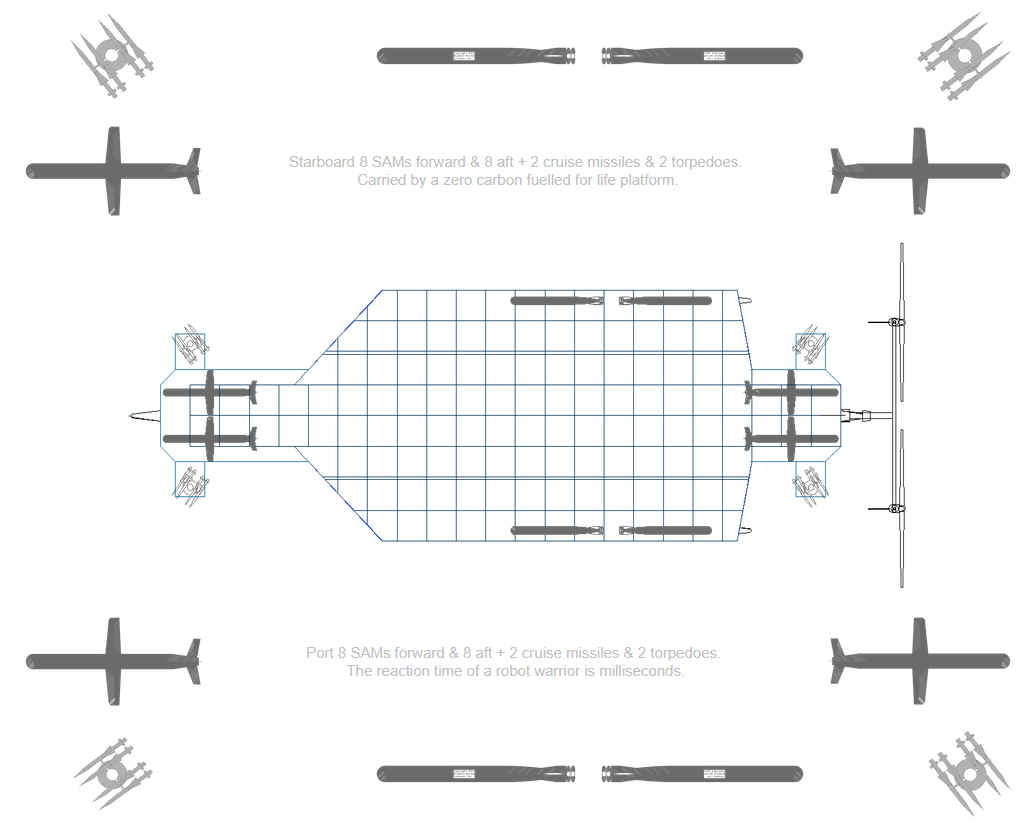
A
SeaWolf ZCC, robotic destroyer draft design from 2013
WOLVERINE
ZCC
To
help reduce the expense of convoys, and to track back missile and drone
attacks, the Wolverine
ZCC, or SeaWolf
system was proposed in 2013, with a patent granted for autonomous navigation
too late to make any real difference in NATO
and MOD
worlds. This would remain the case until the Russian war with Ukraine,
when drone warfare came into its own. When, suddenly the British Royal
Navy ordered small drone speedboats from Kraken Technology in
Portsmouth, in March of 2026. That was after the Frigate un-readiness
fiasco, embarrassed prime minister Kier Starmer. And the less said about Astute
submarines, the better. £Billions
of taxpayer's money wasted, and that includes the Elizabeth
class aircraft carriers.
The
fact is that the United States could have been ahead of the game, but
that they are traditionally slow on the uptake. The Senate needs to be dragged to the trough, kicking and
screaming, in order to disturb procurement payments to favoured
subcontractors. A sad fact their enemies are sure to exploit, during
hostilities.
The
concept is more aimed at peacekeeping duties, an effort to contain the
price of policing politically sensitive waters.
ACIDIFICATION
- ADRIATIC - AEGEAN
- ARCTIC
- ATLANTIC - BALTIC
- BAY BENGAL - BAY
BISCAY - BERING
- BLACK - CARIBBEAN - CORAL
- EAST CHINA - ENGLISH
CH -
FINLAND - GOC
- GULF GUINEA - GULF
MEXICO - GULF THAILAND - GULF
TONKIN - HORMUZ - INDIAN -
IONIAN
- IOC
-
IRC
- IRISH
- MEDITERRANEAN - NORTH
SEA - PACIFIC - PERSIAN
GULF
RED
SEA - SEA JAPAN
- STH
CHINA - PLASTIC
- PLANKTON - PLASTIC
OCEANS - RED - SARGASSO
- SEA
LEVEL RISE - SOUTHERN
OCEAN -
TAIWAN - TYRRHENIAN
- UNCLOS
- UNEP
WOC
- WWF
AMAZON
- BURIGANGA - CITARUM -
CONGO -
CUYAHOGA
-
GANGES - IRTYSH
- JORDAN -
LENA -
MANTANZA-RIACHUELO
MARILAO
- MEKONG -
MISSISSIPPI -
NIGER -
NILE -
PARANA -
PASIG -
SARNO - THAMES
- YAMUNA -
YANGTZE -
YELLOW -
ZHUJIANG
LINKS
& REFERENCE
http://
FICTION
- Operation
Neptune - An
advanced nuclear submarine is hijacked by environmental extremists intent on
stopping pollution from the burning of fossil fuels. The extremists torpedo a
number of oil wells as part of a campaign to cause energy chaos, with bigger
plans to come. If you enjoyed
Battleship,
Under Siege or
The Hunt for Red
October, this is a
must for you.
|